-
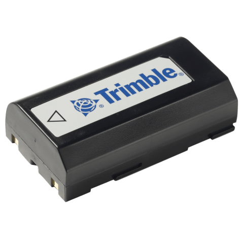 Accessory - MT1000, R6, R8, Dini Battery
 -
 Accessory - RTS/RPT - Li-Ion Battery compatible for all S and X series (except X12) batteries and plus Focus 30, RTK, SPS.
 -
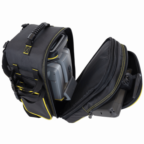
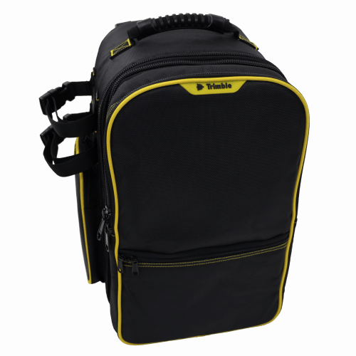 Features include: • Main compartment with custom foam insert for all Trimble S Series and VX instruments • Removable front compartment with built in backpack straps. Contains large front pocket for data collector and small front half pocket for small item storage • Side pockets for miscellaneous accessories•Padded back and adjustable shoulder straps for comfort • Durable 1680D Polyester fabric • Webbing system on both sides and bottom for securing additional equipment (2 straps included) • Airline carry-on compatible for most aircraft Approximate dimensions with instrument inside*: (*Note Instrument sold separately) Overall Dimensions: H: 440mm x W: 325mm x D: 305mm (17.25” x 12.75" x 12") Main instrument compartment depth when separated D: 216 mm (8.5”) Front controller compartment depth when separated D: 89mm (3.5”)
 -
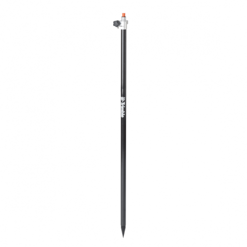
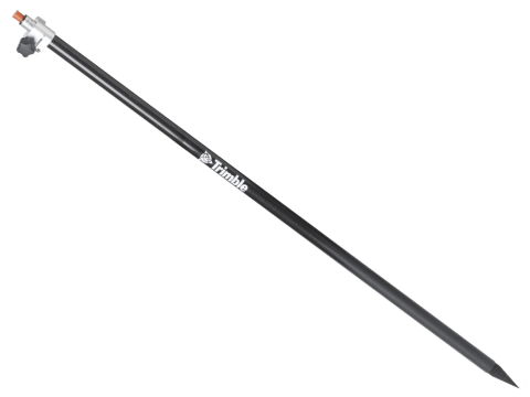
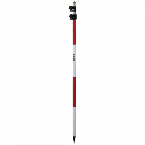
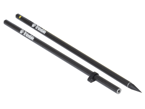 Accessory - Layout Rod - 2m Fixed Height Carbon Fiber Rod. Fixed height two part, 2 meter, carbon fiber range pole. P/N: 43169-10
 -
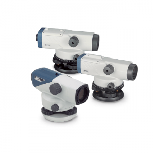 The Sokkia Auto Levels Model B20, B30A and B40A are durable, dependable, high value auto levels.
 -
 Waterproof and corrosion resistant. Also is perfect for laser detector mounting.
 -
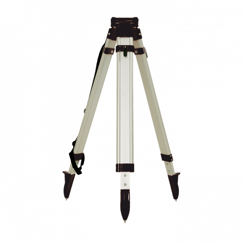 Seco Aluminum Tripod with Round Legs Quick Clamp - Black. These tripods accommodate all types of jobs.
 -
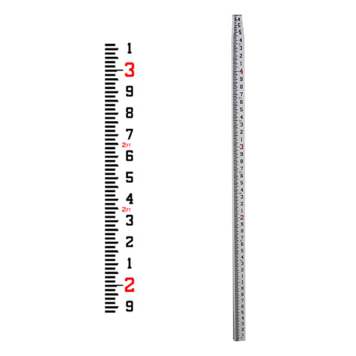
 The rectangular-oval shape allows for wide, glare resistant scales that are wear-resistant.
 -
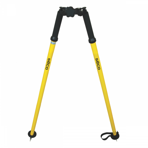 Seco Thumb release Bipod converts a GPS Rover Rod into a tripod and legs extend to 6 feet for use in uneven terrain. Within seconds the operator can set up a free standing GPS antenna pole or prism pole.
 -
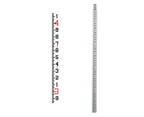
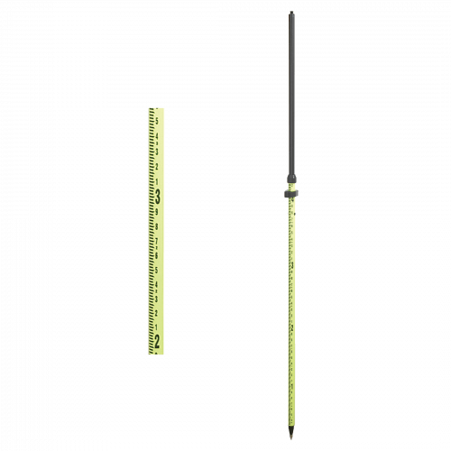 The rod telescopes, locks at 2 meters, and collapses back to 1.354 meters The lightweight aluminum rod comes with a 40-minute vial Hardware is Flo Yellow Weighs 2.35 lb (1.07 kg)
 -
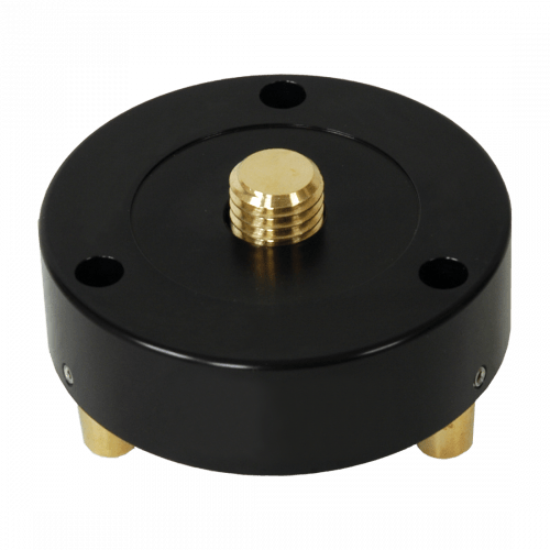
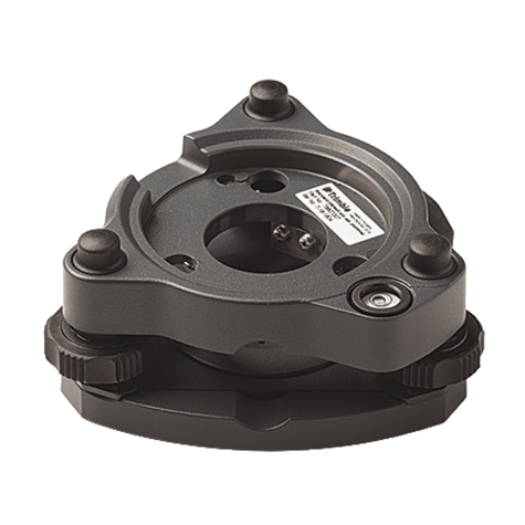 Replacement Tribrach for Trimble S Series instruments or Trimble Traverse Prism kit. Also compatible with Trimble SX10 instrument.
 -
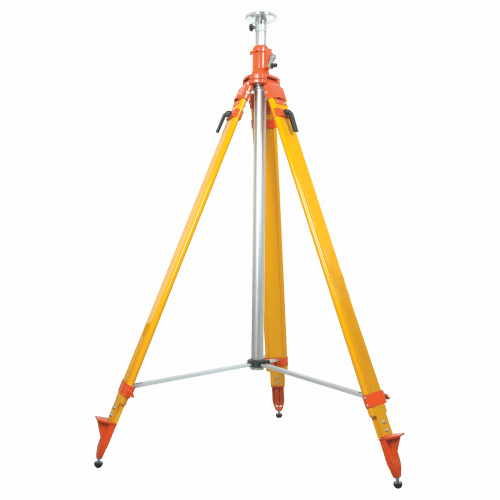 Features an adjustable center column that gives the tripod 3.69-ft (1.12-m) of lift.
 -
 Comes with a 40-minute adjustable circular vial
 -
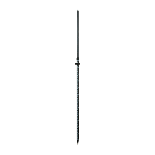
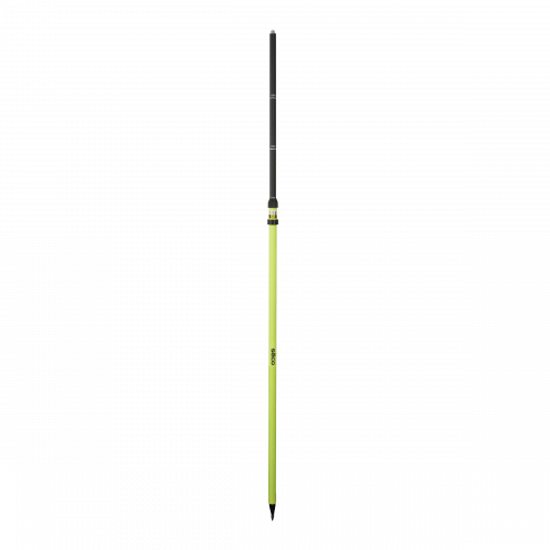
 Rod - 2.5m Carbon Fiber Telescopic Range Pole without Bipod
 -
 Made of strong fiberglass, Waterproof and corrosion-resistant, Perfect for laser detector mounting and The CR Series is non-conductive
 -
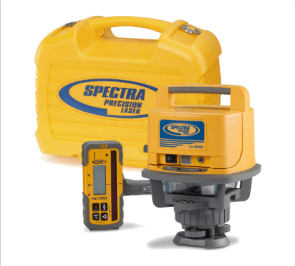
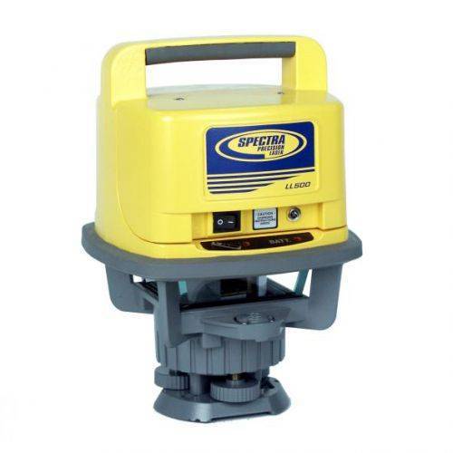 Spectra Precision® Laser Level LL500 comes with HL700 Receiver, Clamp & Alkalines. Seiler services and supports all products we sell!
 -
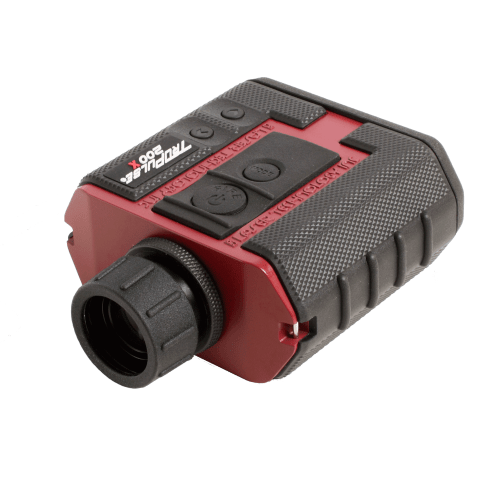
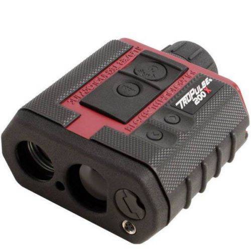 The TruPulse 200X laser rangefinder was designed to make high precision measurements for professionals working in challenging field conditions. The 200X provides an in-scope LED display that easily adjusts to varying light conditions, with its advanced inclination and distance accuracy, makes this laser rangefinder the most progressive product in the TruPulse Series line. Contact your local Mapping GIS Sales Professional for a demonstration and full details.
 -
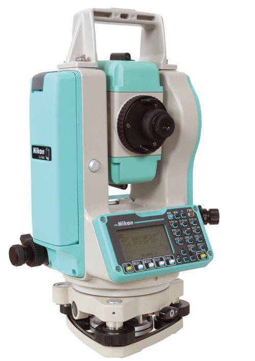 Sale Price listed while supplies last!- CURRENTLY OUT OF STOCK The Nikon NPL-322+ Series of mechanical total stations includes a 5" single face model. Nikon total stations are economical, versatile, easy to use, and feature Nikon's legendary optics. Product includes:
- Angle accuracy: 5" (1.5mgon) (ISO 17123-3)
- EDM type: Reflectorless technology
- Distance accuracy: 2 mm + 2 ppm Distance range: Up to 3,000m (9,840 ft) to single prism (ISO 17123-4)
- Reflectorless range: Up to 400 m (1312 ft) (KGC 90%)
- Compensator: Dual axis
- Compact, lightweight total station
- Graphic LCD display, Single face
- Full numeric keyboard, Single face
- Internal memory of 25,000 records
- Internal Bluetooth, laser pointer
- 1x NPL-322+ main unit
- 2x Li-Ion Long-life Batteries
- 1x Clip-on Battery Holder
- 1x Tribrach
- 1x Plastic Carrying Case
- 1x Universal Charger, Power Cord and Adapters
- Total weight on bundle above is 23 lbs. Box dimensions 21 ½” x 13 ¾” x 15”
-
 This rotating friction top tribrach adapter allows the prism to be pointed after installation in the tribrach Fits all tribrachs Weighs 0.9 lb (0.41 kg)
 -
 These lightweight aluminum rods come with a 40-minute vial Locking Lengths at 2 m, 1.8 m, 1.6 m Weighs 2.34 lb (1.06 kg)
 -
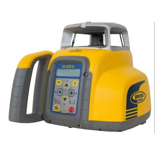 Spectra Precision® GL422N automatic self-leveling single grade laser
 -

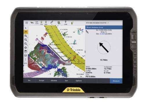 You can depend on It. The T100 is Trimble’s latest high performance tablet. With a sleek, rugged design and 10-inch touchscreen you can read in any conditions, the T100 handles anything the work day dishes out. See full datasheet here. The T100 at a glance...
- Large 10.1-inch touchscreen.
- Full Windows desktop applications.
- Integrated long life battery.
- Ergonomic design.
- Expandable Trimble EMPOWER modules.
- Enjoy the convenience of an all day battery—for a full days work, every day.
-
 Trimble Business Center is Office Software for Surveyors. Contact us for a demonstration and/or quote. Complete your field to finish workflows and expand business opportunities with unique deliverables:
- Topographic base map creation for construction and land development
- Cadastral/ALTA drawings for boundary mapping
- Workflow automation through using templates and feature coding
- Perform Cut/Fill Map analysis, Corridor Design, Inspections and Volume Computations
-
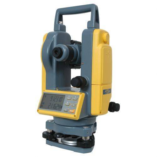 DET-2 Construction Theodolite The Spectra Precision® DET-2 is a rugged, cost-effective theodolite designed to give accurate angle measurements in general construction applications.
 -
 The CR600 can be either rod or machine mounted, making it ideal for a wide range of applications.
 -
 The HL450 Laser Receiver features a digital readout of elevation that provides a numeric display of ± 40 mm or ±1.5 inches. The readout is displayed on the large front and rear LCD’s and shows exactly how far the elevation is from on-grade. Accurate measurements can be made without moving the rod clamp, saving time and increasing productivity.
 -
 For interior building and remodeling, the LT20G laser tool is ideal for brighter working conditions
 -
 This adapts retro prisms to Swiss-style tribrachs Includes a removable Zeiss plug and locking screw Fits all tribrachs Weighs 1.75 lb (0.80 kg)
 -
 Use this adapter for mounting retro prisms and tripod mounted target systems Fits all tribrachs Weighs 0.50 lb (0.23 kg)
 -
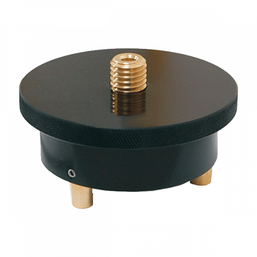
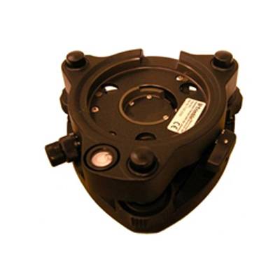 Accessory - RTS - Tribrach with Optical Plummet
 -
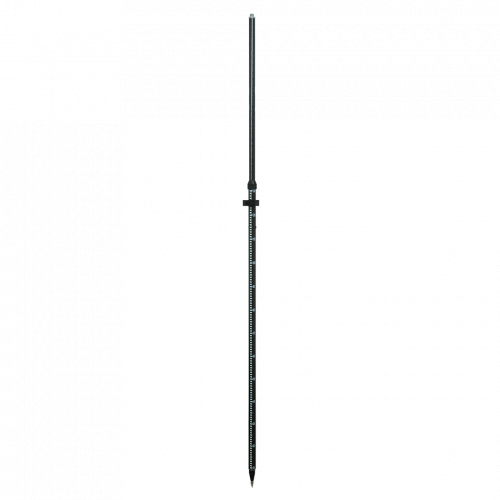
 Markings offset by Trimble Standard target height (135mm) Carbon fiber and aluminum telescopic range pole - 2.6 meter. Accessory - Layout Rod - 2.6m Telescopic Rod
 -
 Perfect for all GPS applications
 -
 Dual Grad (0.01 ft/cm) Adjustable Tip Powder-coated and silk screened aluminum Red and White 11.81 ft (3.60 m) extended, 5.18 ft (1.58 m) closed Weighs 5.10 lb (2.32 kg)
 -
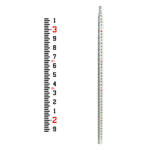
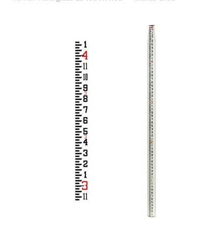 Features a new shorter collapsed length 58.5 inches and a lighter weight,Constructed of strong, rigid fiberglass with reinforcing ribs for added stability,Waterproof and non-conductive,The rectangular-oval shape allows for wide, glare resistant scales that are wear-resistant,Tight locking mechanism features round buttons that resist jamming from sand and dirt,Features a 1/4 x 20 female adapter in top section,Graduations 8ths, Length 25 ft and Weighs 6.00 lb (2.72 kg)
 -
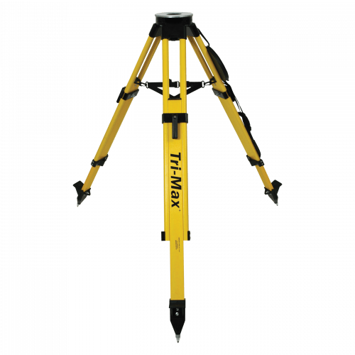 The only surveying grade tripod with certified accuracy. Recommended for all servo-driven and robotic total stations, 3-D laser scanners or construction lasers.
 -
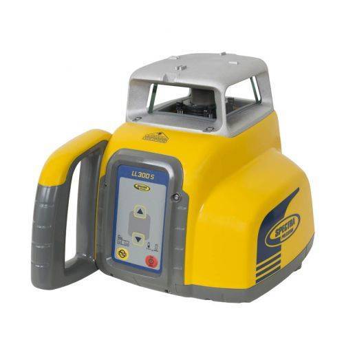 Automatic, self-leveling Spectra Precision® LL300S Laser Level.
 -
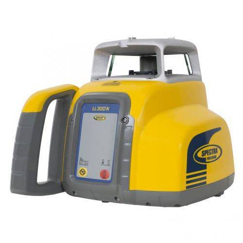 Automatic, self-leveling Spectra Precision® LL300N Laser Level.
 -

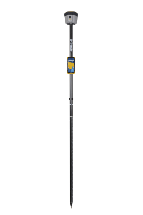
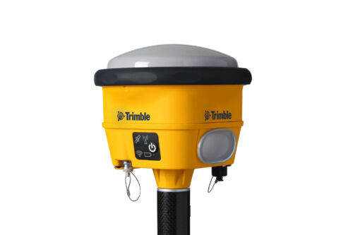
 Unmatched GNSS Performance With Connected Workflows to Elevate Survey Productivity. The Trimble® R980 GNSS system unlocks peak accuracy and connectivity with proven Trimble GNSS performance, now more powerful than ever before. Trimble ProPoint® GNSS technology ensures robust data capture even in tough environments, while high-performance Trimble Inertial Platform™ (Trimble TIP™) IMU-based tilt compensation keeps you focused on the job at hand.
 -

The Trimble® TDC6 data collector is a powerful, versatile and cost-effective field data collection solution for surveying and mapping professionals. Use the TDC6 standalone as a GIS data collector, paired with a GNSS receiver or as an onboard total station controller.
-
 Wireless Tiltmeter Monitoring sensor with internal antenna. Precise Movement Detection.
 -
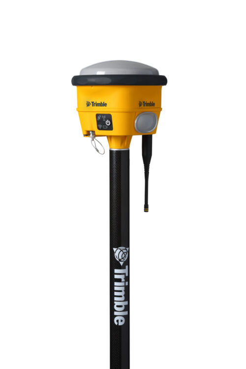 The Trimble® R780 GNSS receiver allows you to choose your configuration and scale up by adding additional features. With robust GNSS positioning technologies, trust this ultra-durable receiver to boost your productivity and flexibility in any environment.
 -
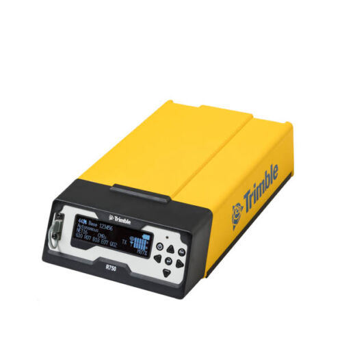
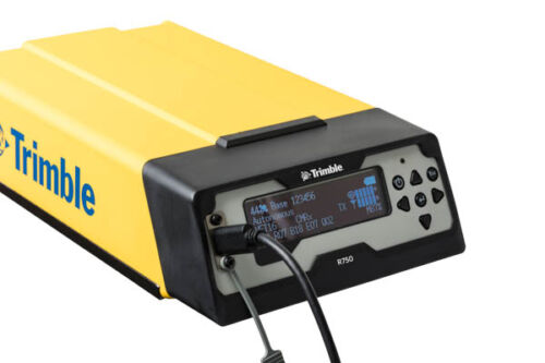 Get reliable coverage no matter where you work with the Trimble® R750 modular GNSS receiver. Work efficiently and accurately, even in tough conditions, while receiving all the information you need, right at your fingertips.
 -
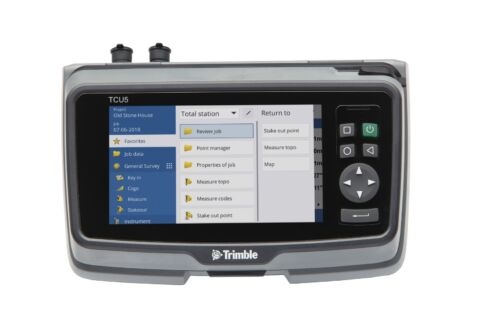
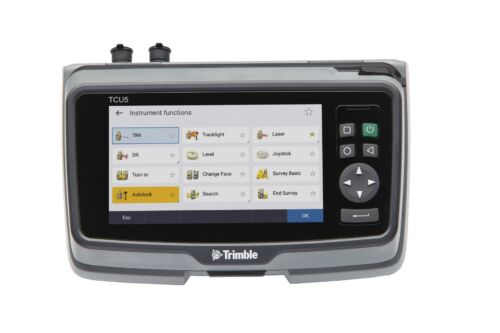 TCU5 Model 2 rugged field controller elevates your productivity
 -
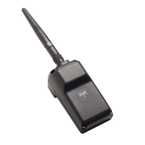 Trimble EMPOWER robotic radio module to connect with total stations. ONLY AVAILABLE FOR DELIVERY IN MO, IA, IL, IN, KY, MI, NE, and WI
 -
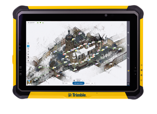
Push the limits of productivity. Tackle large scanning datasets and workflows confidently with the Trimble® T10x tablet.
-
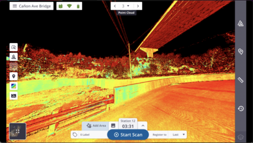
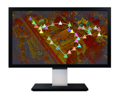 Trimble Perspective field software is specifically designed for in-field scanner control and complete registration when working with a Trimble 3D laser scanning system like Trimble X9 or X12.
 -
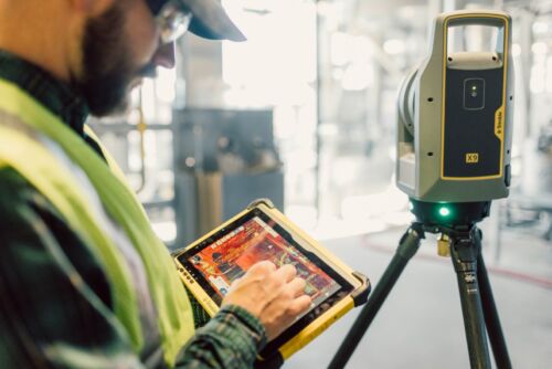
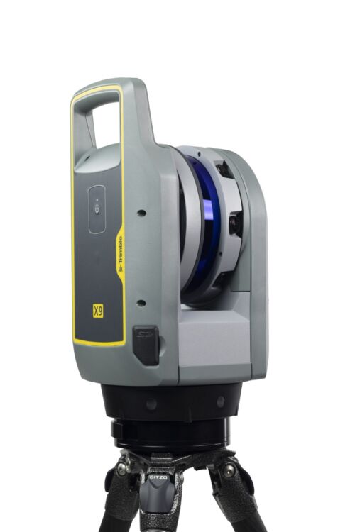 A 3D laser scanning system built with proven Trimble technologies, offering the range, accuracy, scan times and sensitivity you need to do more, better, and faster.
