-
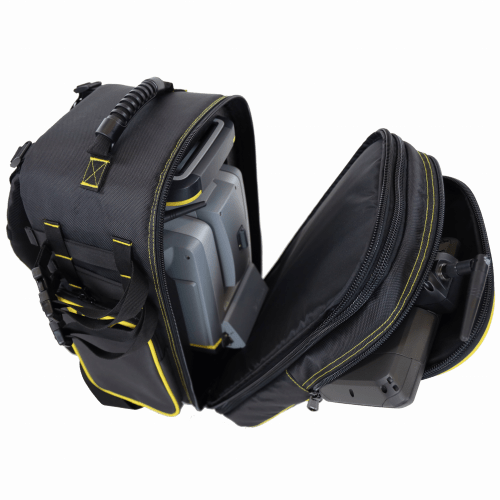
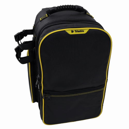 Features include: • Main compartment with custom foam insert for all Trimble S Series and VX instruments • Removable front compartment with built in backpack straps. Contains large front pocket for data collector and small front half pocket for small item storage • Side pockets for miscellaneous accessories•Padded back and adjustable shoulder straps for comfort • Durable 1680D Polyester fabric • Webbing system on both sides and bottom for securing additional equipment (2 straps included) • Airline carry-on compatible for most aircraft Approximate dimensions with instrument inside*: (*Note Instrument sold separately) Overall Dimensions: H: 440mm x W: 325mm x D: 305mm (17.25” x 12.75" x 12") Main instrument compartment depth when separated D: 216 mm (8.5”) Front controller compartment depth when separated D: 89mm (3.5”)
 -
 Accessory - RTS/RPT - Li-Ion Battery compatible for all S and X series (except X12) batteries and plus Focus 30, RTK, SPS.
 -

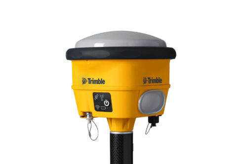
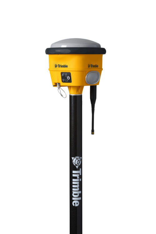
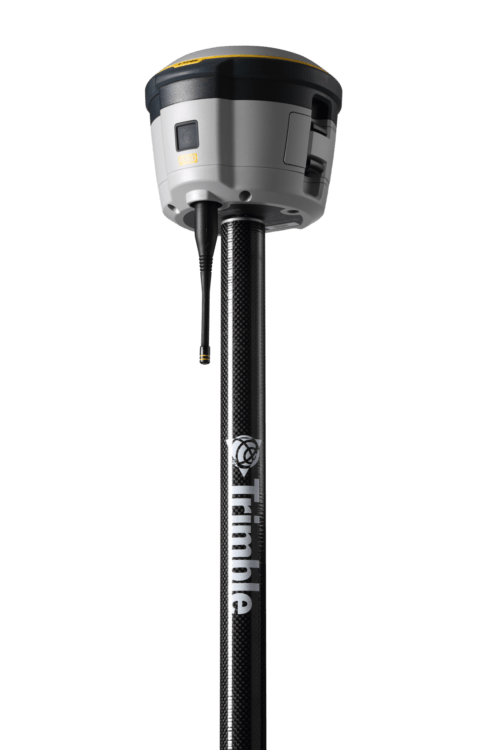
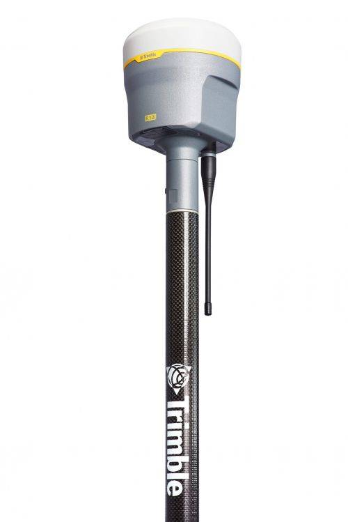
 Unmatched GNSS Performance With Connected Workflows to Elevate Survey Productivity. The Trimble® R980 GNSS system unlocks peak accuracy and connectivity with proven Trimble GNSS performance, now more powerful than ever before. Trimble ProPoint® GNSS technology ensures robust data capture even in tough environments, while high-performance Trimble Inertial Platform™ (Trimble TIP™) IMU-based tilt compensation keeps you focused on the job at hand.
 -
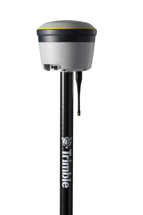
 The Trimble® R780 GNSS receiver allows you to choose your configuration and scale up by adding additional features. With robust GNSS positioning technologies, trust this ultra-durable receiver to boost your productivity and flexibility in any environment.
 -
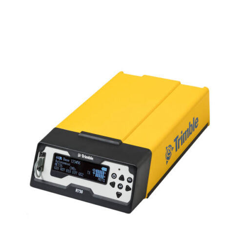
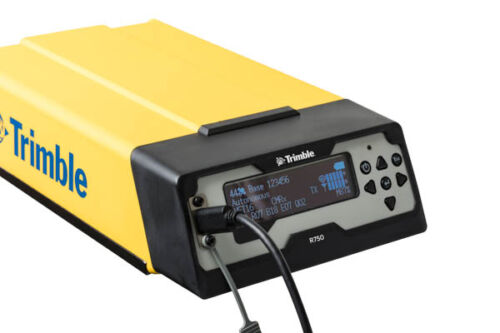 Get reliable coverage no matter where you work with the Trimble® R750 modular GNSS receiver. Work efficiently and accurately, even in tough conditions, while receiving all the information you need, right at your fingertips.
 -
 Proven reliable positioning
Depend on the Trimble® R580 GNSS system to keep you working with survey precision. Powered by the industry-leading Trimble ProPoint® GNSS engine, this everyday integrated receiver delivers greater productivity and reliable accuracy in more places.
Benefits and performance
With increased accuracy and reliability in difficult urban and rural environments, the Trimble R580 optimizes productivity using powerful GNSS technologies for maximum results.Productivity maximized
The Trimble R580 harnesses Trimble ProPoint technology so you can survey with precision in difficult places, boosting field work productivity like never before.Trimble dependability
With proven technology to guard against anti-spoofing and multipath issues, the dependable R580 provides confidence for every measurement and point you capture. -
 The Trimble® R2 is a compact, durable GNSS receiver that provides an easy-to-use solution for GIS and survey professionals who need to collect highly accurate data in a wide range of geospatial applications.
 -
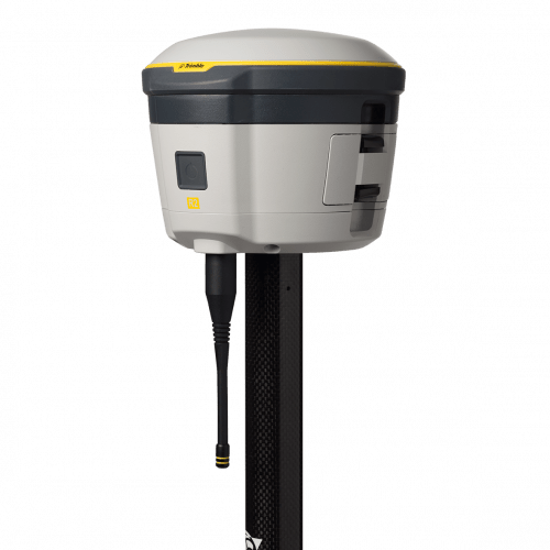
Trimble® R12i with Trimble ProPoint™ GNSS technology and new Trimble TIP™ tilt compensation
The R12i delivers unmatched GNSS performance, speed and accuracy to boost your productivity like never before. With improved performance in challenging GNSS conditions and robust IMU-based tilt compensation that lets you forget about leveling the pole, you'll get more done faster than you thought possible. Get the FAQs here! -
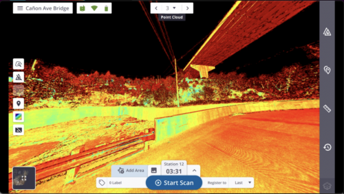
 Trimble Perspective field software is specifically designed for in-field scanner control and complete registration when working with a Trimble 3D laser scanning system like Trimble X9 or X12.
 -
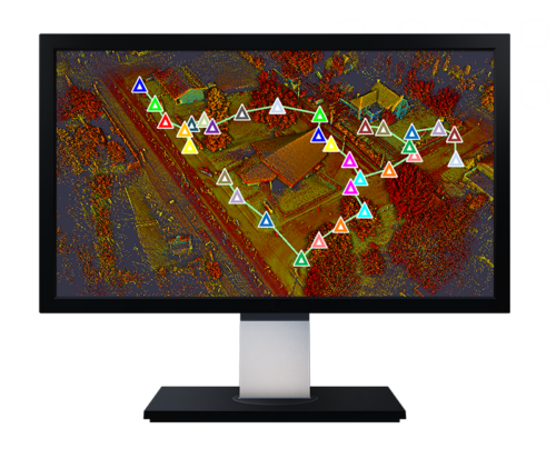
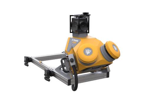
 Trimble Mobile MX9 LiDAR Mapping Imaging Solution is for Large-Scale Scanning and Mapping Missions. The MX9 is a complete field-to-finish mobile mapping solution combining state-of-the-art, advanced hardware with intuitive field software and a reliable, efficient office software workflow. Contact your local Survey Sales Professional for a demonstration and full details.
 -
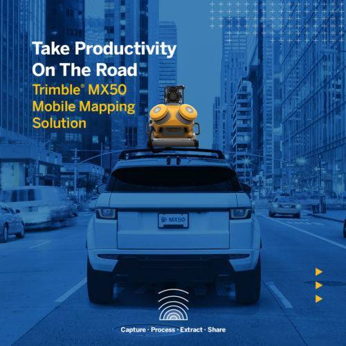
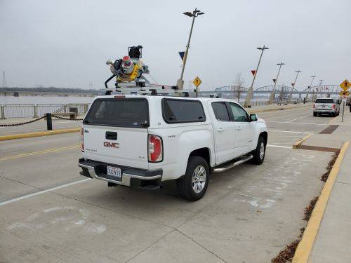
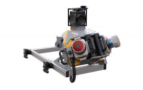
 The Trimble® MX50 is a practical field-to-finish mobile mapping solution for asset management, mapping, and road maintenance. The system delivers a very accurate point cloud of the environment along with complementary immersive imagery providing substantial gains in productivity. Contact your local Survey Sales Professional for a demonstration and full details.
 -
 Both active & passive tracking to locate and lock-on to the correct target
 -
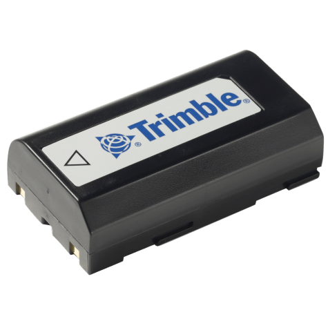 Accessory - MT1000, R6, R8, Dini Battery
 -
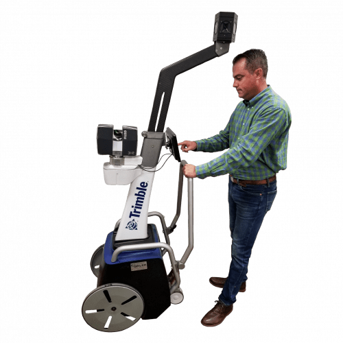 The Trimble Indoor Mobile Mapping Solution (TIMMS) is the optimal fusion of technologies for capturing spatial data of indoor and other GNSS denied areas.
 -
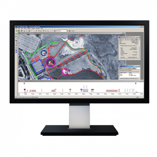 Powerful and easy to use GNSS/GPS data processing software.
 -
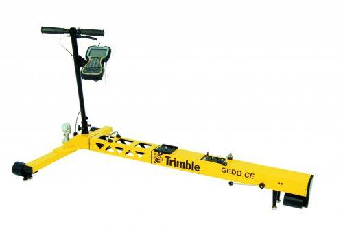
Trimble GEDO Track is a simple, integrated system to measure for precise adjustments, inspections and quality checks. In one operation, the Trimble GEDO captures the 3D coordinates of the track, together with gauge and cant. With its precision measurement systems, Trimble GEDO is suitable for conventional and high-speed rail construction. Contact us for more details and quote
KEY BENEFITS
- Reduce construction time and costs with immediate comparison of measured data to design
- Verify track geometry with accuracy and confidence. Precise optical positioning and a simple, self-contained trolley provide flexibility and reliable results
- Capture track 3D coordinates, gauge and cant in a single operation
- Import alignment design from digital or paper plans. Check design information before it goes to the job site
- Reduce time for documentation and acceptance. Capture adjustment and track acceptance data and quickly prepare reports for contractors and quality inspection
- Support for industry standard calculations including FAKOP® widening
- Satisfy reporting requirements with graphical and list form output of corrections for side and height correction plates
-
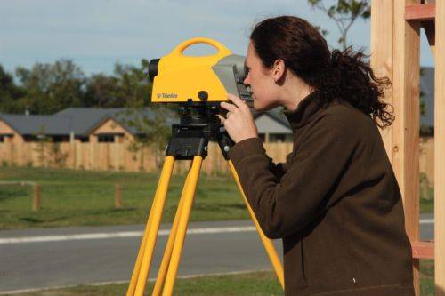
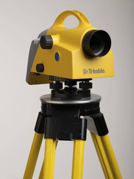 Trimble DiNi Level Digital Height measurement sensor - Trimble Quality and Accuracy for Measuring with Confidence. Contact us to buy or learn more.
- Determine accurate height information 60% faster than with automatic leveling
- Eliminate errors and reduce rework with digital readings
- Transfer data to the office easily
- Level Accuracy 0.3 or 0.7 mm
-

 The Trimble DA2 GNSS receiver is the next generation receiver for the Trimble® Catalyst™ GNSS positioning service. The DA2's performance scales with your Trimble Catalyst service subscription to deliver anywhere from centimeter to sub-meter precision to location-enabled Android™ and iOS field apps & workflows. Order or learn more here about Catalyst.
 -
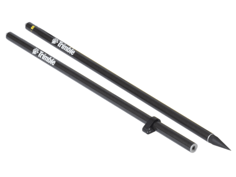
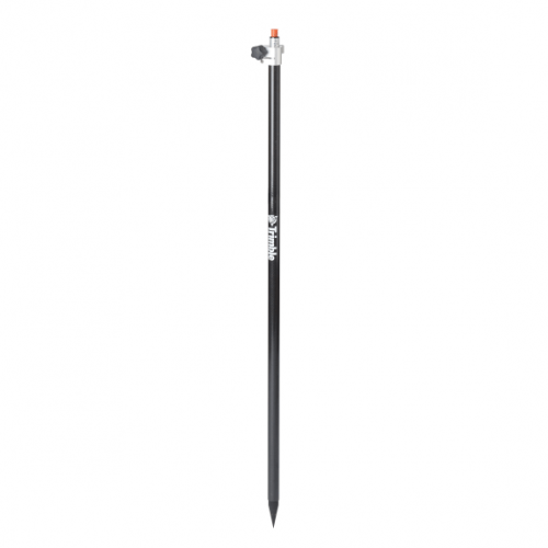 Rod - 2.5m Carbon Fiber Telescopic Range Pole without Bipod
 -
 Trimble Business Center is Office Software for Surveyors. Contact us for a demonstration and/or quote. Complete your field to finish workflows and expand business opportunities with unique deliverables:
- Topographic base map creation for construction and land development
- Cadastral/ALTA drawings for boundary mapping
- Workflow automation through using templates and feature coding
- Perform Cut/Fill Map analysis, Corridor Design, Inspections and Volume Computations
-
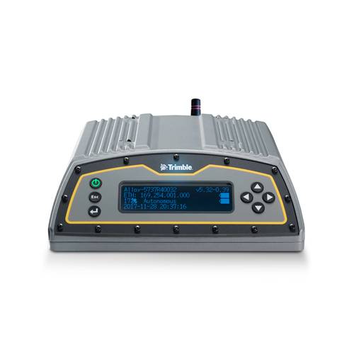 The Trimble Alloy™ reference receiver is ready to take on the requirements of any real-time network, in any environment, anywhere in the World. With tough IP68 housing, and modernized satellite tracking Trimble Alloy receiver can also be used as a campaign receiver for post-processing, as a Continuously Operating Reference Station (CORS) receiver or portable base station for Real-time Kinematic (RTK) applications – and even as a scientific reference station.
 -
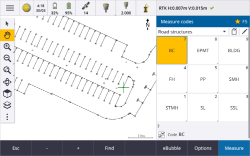
 Trimble Access™ software suite offers surveyors and geospatial professionals a range of specialized field applications designed to make fieldwork easier.
 -
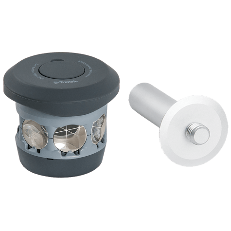 The 360 prism designed for Integrated Surveying with the Trimble R10 GNSS receiver. Compatible with all optical instruments. Request a quote - contact us. Accessory - RTS/RPT - 360 Prism includes height adapter to Trimble Standard target height (135mm).
 -
 Accessory - Layout Rod - 2m Fixed Height Carbon Fiber Rod. Fixed height two part, 2 meter, carbon fiber range pole. P/N: 43169-10
