-
 The CR600 can be either rod or machine mounted, making it ideal for a wide range of applications.
 -
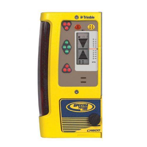
 The HL450 Laser Receiver features a digital readout of elevation that provides a numeric display of ± 40 mm or ±1.5 inches. The readout is displayed on the large front and rear LCD’s and shows exactly how far the elevation is from on-grade. Accurate measurements can be made without moving the rod clamp, saving time and increasing productivity.
 -
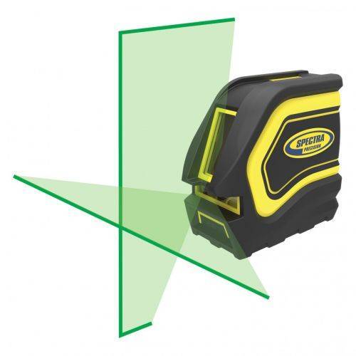 For interior building and remodeling, the LT20G laser tool is ideal for brighter working conditions
 -
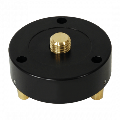
 This adapts retro prisms to Swiss-style tribrachs Includes a removable Zeiss plug and locking screw Fits all tribrachs Weighs 1.75 lb (0.80 kg)
 -
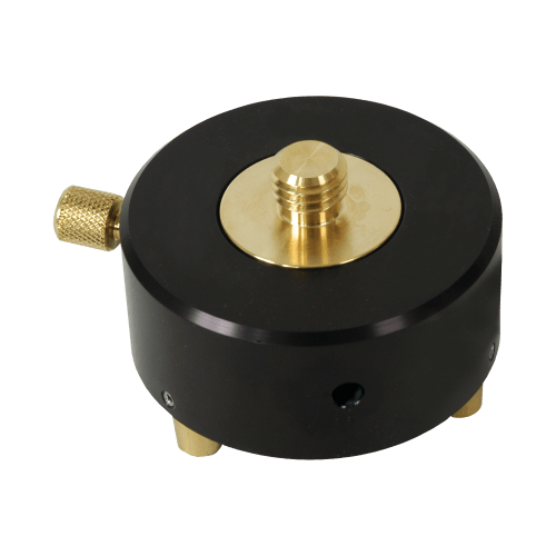
 Use this adapter for mounting retro prisms and tripod mounted target systems Fits all tribrachs Weighs 0.50 lb (0.23 kg)
 -
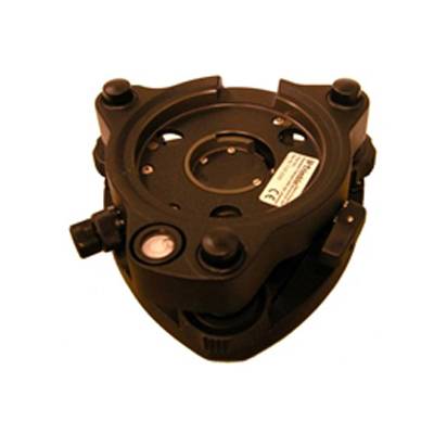 Accessory - RTS - Tribrach with Optical Plummet
 -
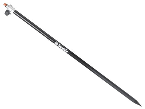 Markings offset by Trimble Standard target height (135mm) Carbon fiber and aluminum telescopic range pole - 2.6 meter. Accessory - Layout Rod - 2.6m Telescopic Rod
 -
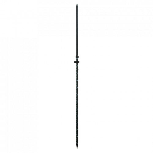 Perfect for all GPS applications
 -
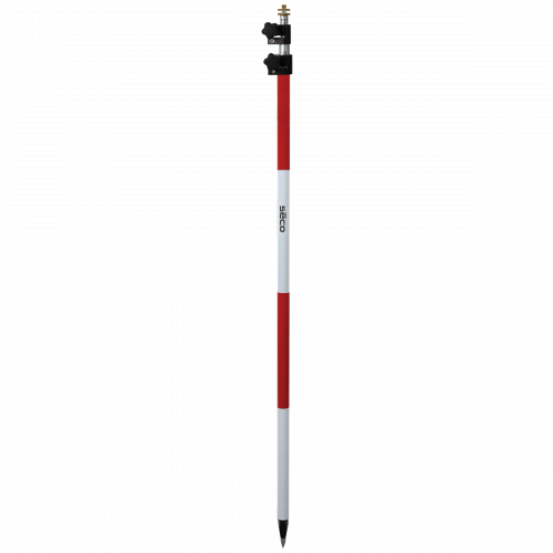 Dual Grad (0.01 ft/cm) Adjustable Tip Powder-coated and silk screened aluminum Red and White 11.81 ft (3.60 m) extended, 5.18 ft (1.58 m) closed Weighs 5.10 lb (2.32 kg)
 -
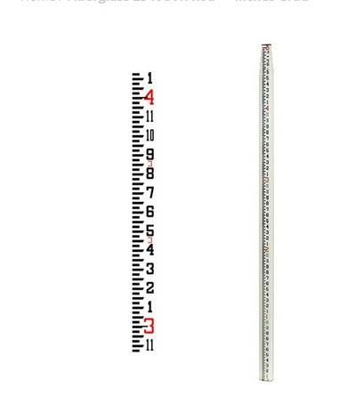 Features a new shorter collapsed length 58.5 inches and a lighter weight,Constructed of strong, rigid fiberglass with reinforcing ribs for added stability,Waterproof and non-conductive,The rectangular-oval shape allows for wide, glare resistant scales that are wear-resistant,Tight locking mechanism features round buttons that resist jamming from sand and dirt,Features a 1/4 x 20 female adapter in top section,Graduations 8ths, Length 25 ft and Weighs 6.00 lb (2.72 kg)
 -
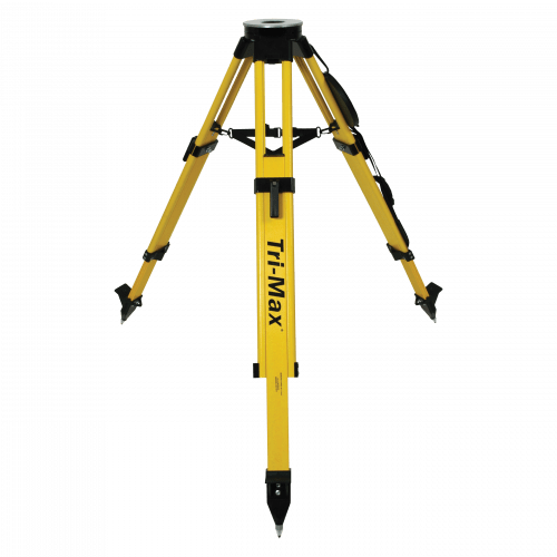 The only surveying grade tripod with certified accuracy. Recommended for all servo-driven and robotic total stations, 3-D laser scanners or construction lasers.
 -
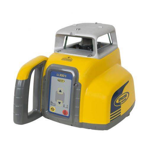 Automatic, self-leveling Spectra Precision® LL300S Laser Level.
 -
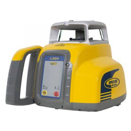 Automatic, self-leveling Spectra Precision® LL300N Laser Level.
 -

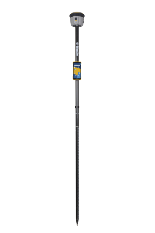
 Unmatched GNSS Performance With Connected Workflows to Elevate Survey Productivity. The Trimble® R980 GNSS system unlocks peak accuracy and connectivity with proven Trimble GNSS performance, now more powerful than ever before. Trimble ProPoint® GNSS technology ensures robust data capture even in tough environments, while high-performance Trimble Inertial Platform™ (Trimble TIP™) IMU-based tilt compensation keeps you focused on the job at hand.
 -

The Trimble® TDC6 data collector is a powerful, versatile and cost-effective field data collection solution for surveying and mapping professionals. Use the TDC6 standalone as a GIS data collector, paired with a GNSS receiver or as an onboard total station controller.
-
 Wireless Tiltmeter Monitoring sensor with internal antenna. Precise Movement Detection.
 -
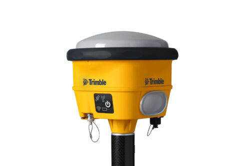
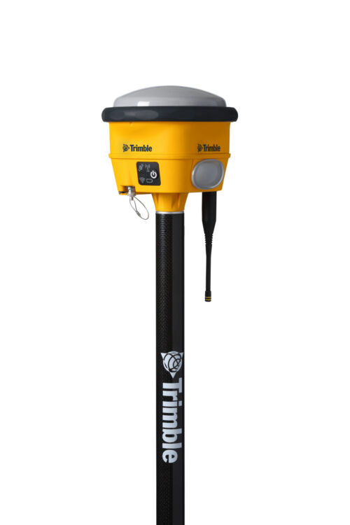 The Trimble® R780 GNSS receiver allows you to choose your configuration and scale up by adding additional features. With robust GNSS positioning technologies, trust this ultra-durable receiver to boost your productivity and flexibility in any environment.
 -
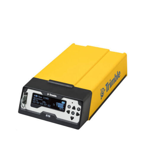
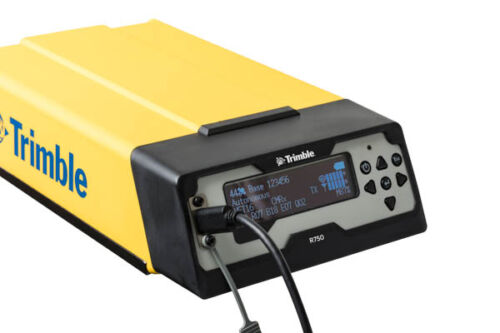 Get reliable coverage no matter where you work with the Trimble® R750 modular GNSS receiver. Work efficiently and accurately, even in tough conditions, while receiving all the information you need, right at your fingertips.
 -
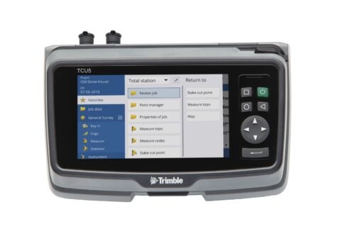
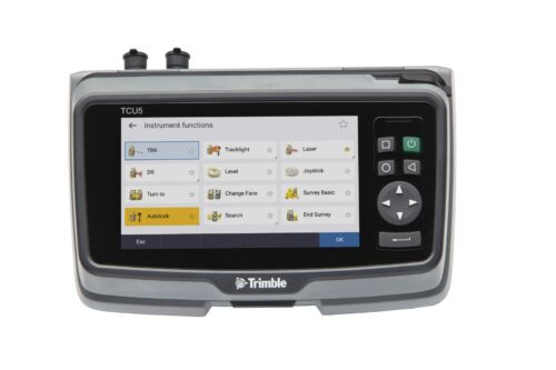 TCU5 Model 2 rugged field controller elevates your productivity
 -
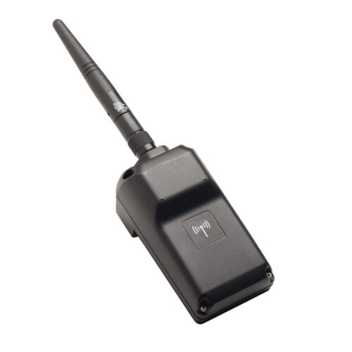 Trimble EMPOWER robotic radio module to connect with total stations. ONLY AVAILABLE FOR DELIVERY IN MO, IA, IL, IN, KY, MI, NE, and WI
 -
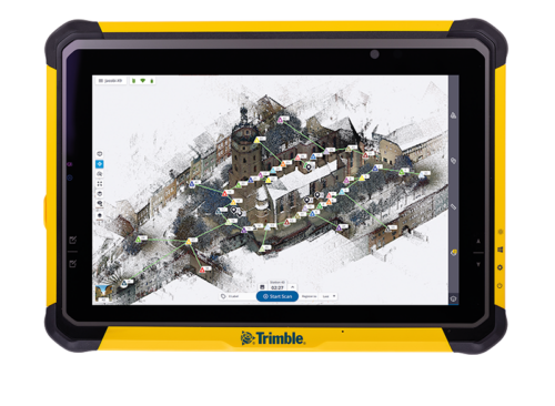
Push the limits of productivity. Tackle large scanning datasets and workflows confidently with the Trimble® T10x tablet.
-
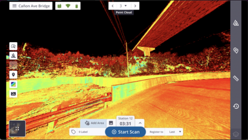
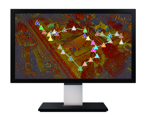 Trimble Perspective field software is specifically designed for in-field scanner control and complete registration when working with a Trimble 3D laser scanning system like Trimble X9 or X12.
 -
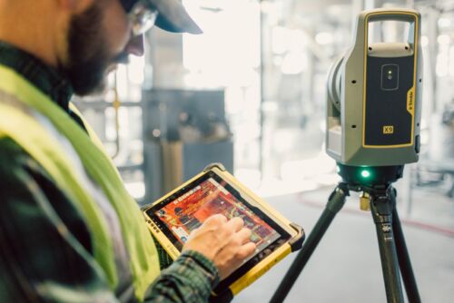
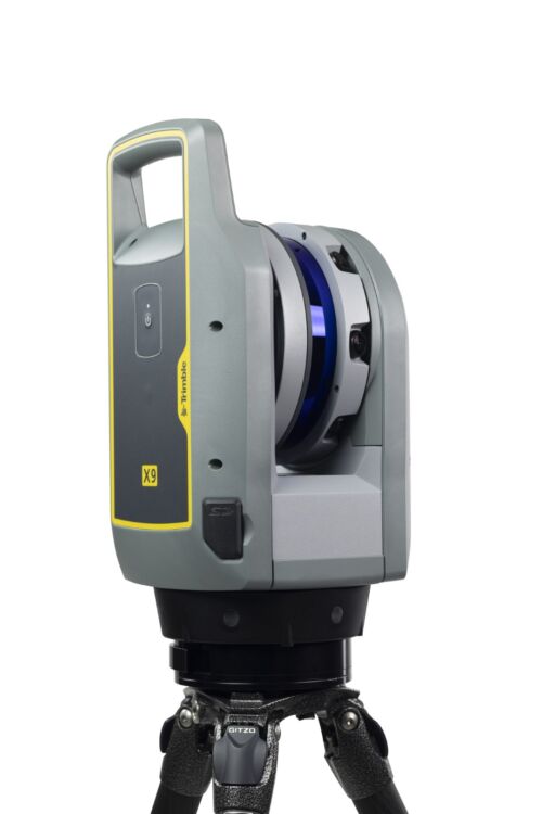 A 3D laser scanning system built with proven Trimble technologies, offering the range, accuracy, scan times and sensitivity you need to do more, better, and faster.
