-
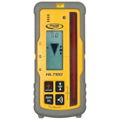 Works with LL400HV, HV302, GL412 and GL422N in automatic Grade Match and PlaneLok applications.
 -
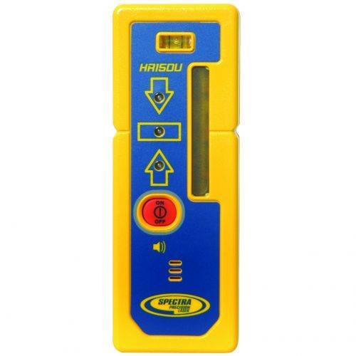 Featuring a tough composite material housing, the HR150 Laser Receiver can withstand a drop of up to 1.5 meters (5 feet) to a hard surface.
 -
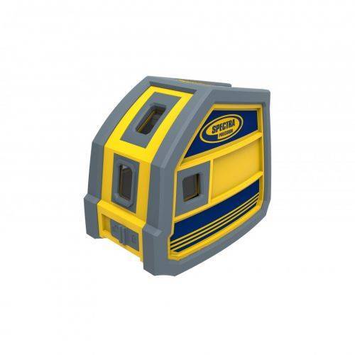
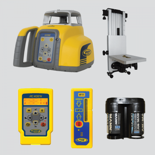 Spectra Precision® HV302G-2 Horizontal/Vertical Laser system includes a M302 Wall Mount, HR150U Laser Receiver, RC402N Radio Remote Control and NiMH/Universal Charger
 -
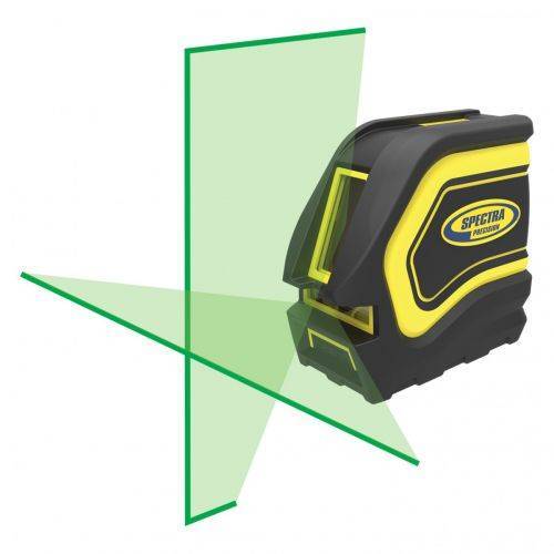
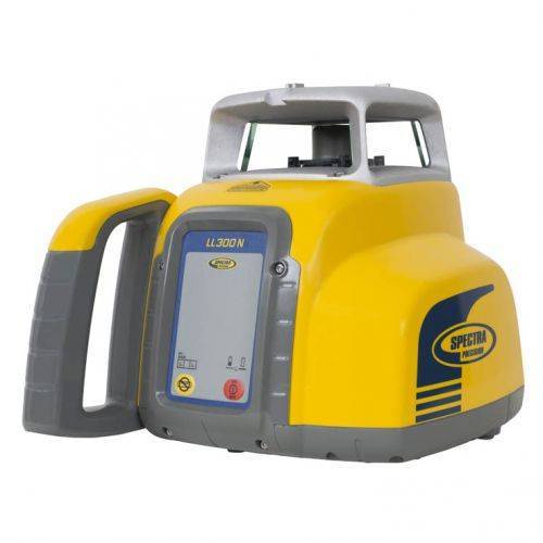 Automatic, self-leveling Spectra Precision® LL300N Laser Level.
 -
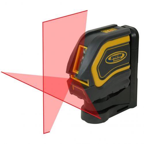
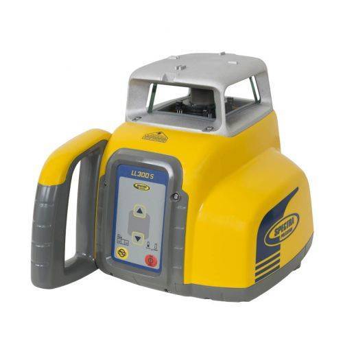 Automatic, self-leveling Spectra Precision® LL300S Laser Level.
 -
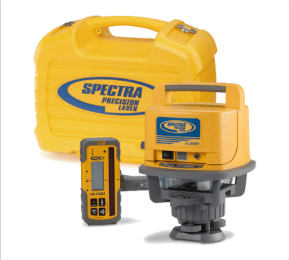
 Spectra Precision® Laser Level LL500 comes with HL700 Receiver, Clamp & Alkalines. Seiler services and supports all products we sell!
 -
 This rugged red beam laser pointer offers several benefits to general and interior contractors, electricians, plumbers and a variety of tradesmen.
 -
 layout tools offer several benefits to general and interior contractors, electricians, plumbers and a variety of tradesmen.
 -
 For interior building and remodeling, the LT20 laser tool is used for horizontal and vertical alignment, wall layout, acoustical ceiling installation and finish carpentry.
 -
 For interior building and remodeling, the LT20G laser tool is ideal for brighter working conditions
 -
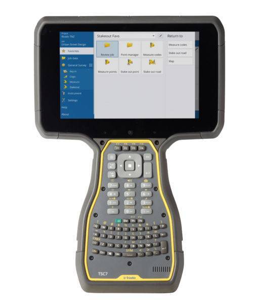
 The third generation Spectra Geospatial Ranger™ Data Collector offers a large bright touch-screen, full alpha-numeric, easy to operate, keypad, and is packed with the features surveyors depend on.
 -
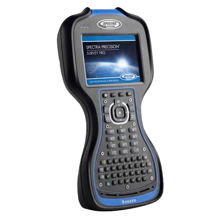
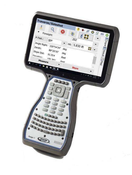 Welcome to the fourth generation Ranger data collector. Its all-new design is based on the experience gained over the last 18 years of demanding field operations. The guiding principles have never changed: productivity, reliability, and quality. A down day is simply not an option. The Ranger 7 continues the legacy of the Ranger data collector by focusing on what is important.
 -
Spectra Pro field software
Survey Pro provides you with a complete set of capabilities for all your survey projects. It’s fast, reliable and easy to use. Transfer data from Survey Pro to your laptop or PC and manage your jobs using Survey Office. Survey Pro software ships on Spectra Geospatial’s rugged line of data collectors providing unparalleled integration, data integrity, efficiency and ease-of-use. The features and functions of Survey Pro have been developed based on feedback from surveyors like you. Each new release of this software incorporates enhancements built on your field experience. Contact us to learn more. -
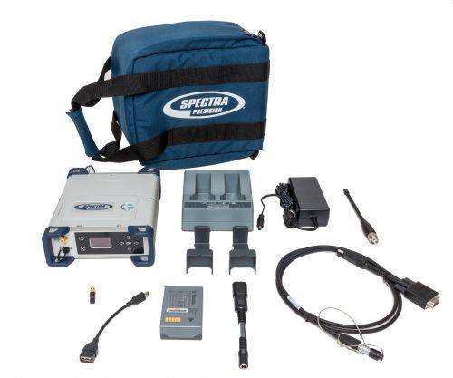
 Product Name: SP85 GNSS Single Receiver Kit with UHF 430-470 MHz 2W TRx Features:
- Patented Z-Blade™ technology
- 600-channel 6G ASIC
- Hot-swappable batteries
- Internal TxRx UHF radio
- L-band satellite capable GNSS antenna
- 3.5G cellular modem
- Built-in WiFi communication
- SMS and e-mail alerts
- Anti-theft technology
- Backup RTK
- RTK bridge
- eLevel technology
- Trimble® RTX correction services
-
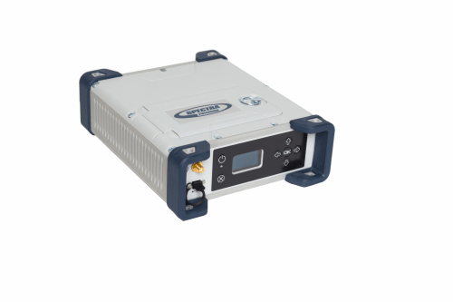 Product Name: Spectra Precision SP90m, Survey, internal 410-470 MHz radio Features:
- Most versatile, modular receiver design
- Ultra-rugged design
- Patented Z-Blade technology
- 480-channel ASIC
- Dual GNSS antenna inputs
- Event marker input
- PPS output
- OLED display, keyboard, and Web UI
- Internal TRx UHF radio
- 3.5G cellular modem
- Built-in Bluetooth and WiFi communication
- SMS and e-mail alerts
- Anti-theft technology
- Backup RTK
- RTK bridge
- 2 MSS L-band channels
- Trimble RTX correction services
-
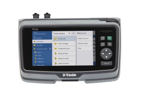
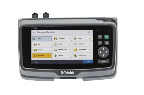 TCU5 Model 2 rugged field controller elevates your productivity
 -
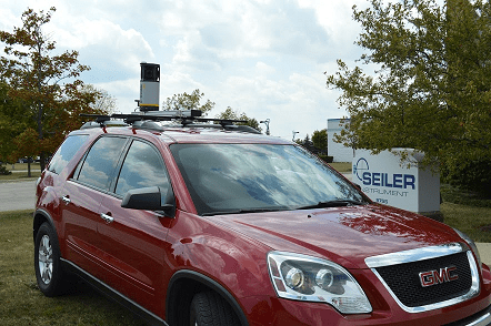
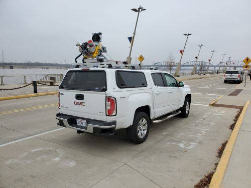
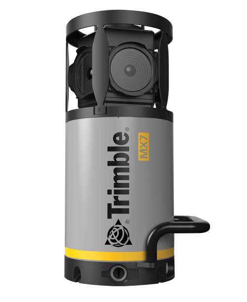 Contact us for details and special pricing! This demonstration unit has full warranty on hardware! The Trimble MX7 is a vehicle-mounted photogrammetric system equipped with six, 5 megapixel cameras, and Trimble Applanix GNSS and inertial geo-referencing modules. The Trimble MX7 can be deployed on vehicles of all sizes, letting you capture 30 MP geo-referenced images at highway speeds.
 -
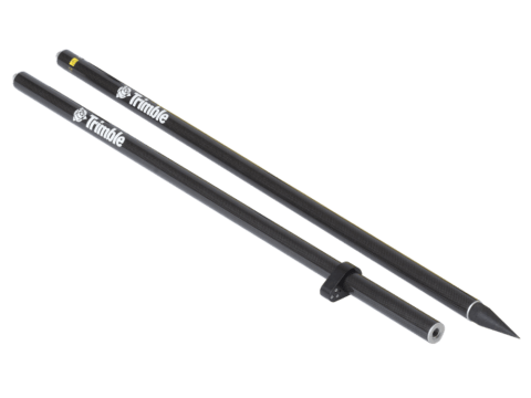
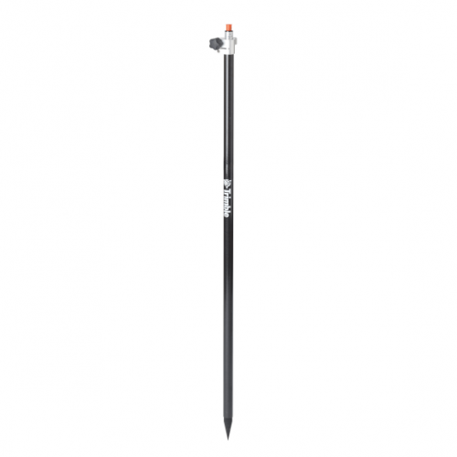
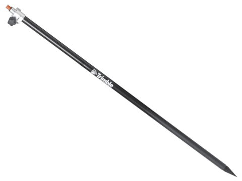 Markings offset by Trimble Standard target height (135mm) Carbon fiber and aluminum telescopic range pole - 2.6 meter. Accessory - Layout Rod - 2.6m Telescopic Rod
 -
 Accessory - Layout Rod - 2m Fixed Height Carbon Fiber Rod. Fixed height two part, 2 meter, carbon fiber range pole. P/N: 43169-10
 -
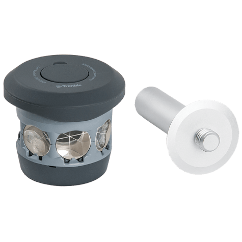 The 360 prism designed for Integrated Surveying with the Trimble R10 GNSS receiver. Compatible with all optical instruments. Request a quote - contact us. Accessory - RTS/RPT - 360 Prism includes height adapter to Trimble Standard target height (135mm).
 -
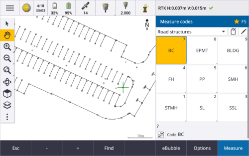
 Trimble Access™ software suite offers surveyors and geospatial professionals a range of specialized field applications designed to make fieldwork easier.
 -
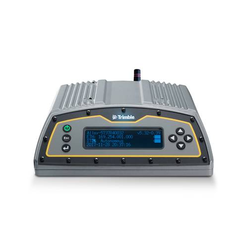 The Trimble Alloy™ reference receiver is ready to take on the requirements of any real-time network, in any environment, anywhere in the World. With tough IP68 housing, and modernized satellite tracking Trimble Alloy receiver can also be used as a campaign receiver for post-processing, as a Continuously Operating Reference Station (CORS) receiver or portable base station for Real-time Kinematic (RTK) applications – and even as a scientific reference station.
 -
 Trimble Business Center is Office Software for Surveyors. Contact us for a demonstration and/or quote. Complete your field to finish workflows and expand business opportunities with unique deliverables:
- Topographic base map creation for construction and land development
- Cadastral/ALTA drawings for boundary mapping
- Workflow automation through using templates and feature coding
- Perform Cut/Fill Map analysis, Corridor Design, Inspections and Volume Computations
-
 Rod - 2.5m Carbon Fiber Telescopic Range Pole without Bipod
 -

 The Trimble DA2 GNSS receiver is the next generation receiver for the Trimble® Catalyst™ GNSS positioning service. The DA2's performance scales with your Trimble Catalyst service subscription to deliver anywhere from centimeter to sub-meter precision to location-enabled Android™ and iOS field apps & workflows. Order or learn more here about Catalyst.
 -
 Trimble DiNi Level Digital Height measurement sensor - Trimble Quality and Accuracy for Measuring with Confidence. Contact us to buy or learn more.
- Determine accurate height information 60% faster than with automatic leveling
- Eliminate errors and reduce rework with digital readings
- Transfer data to the office easily
- Level Accuracy 0.3 or 0.7 mm
-
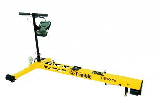
Trimble GEDO Track is a simple, integrated system to measure for precise adjustments, inspections and quality checks. In one operation, the Trimble GEDO captures the 3D coordinates of the track, together with gauge and cant. With its precision measurement systems, Trimble GEDO is suitable for conventional and high-speed rail construction. Contact us for more details and quote
KEY BENEFITS
- Reduce construction time and costs with immediate comparison of measured data to design
- Verify track geometry with accuracy and confidence. Precise optical positioning and a simple, self-contained trolley provide flexibility and reliable results
- Capture track 3D coordinates, gauge and cant in a single operation
- Import alignment design from digital or paper plans. Check design information before it goes to the job site
- Reduce time for documentation and acceptance. Capture adjustment and track acceptance data and quickly prepare reports for contractors and quality inspection
- Support for industry standard calculations including FAKOP® widening
- Satisfy reporting requirements with graphical and list form output of corrections for side and height correction plates
-
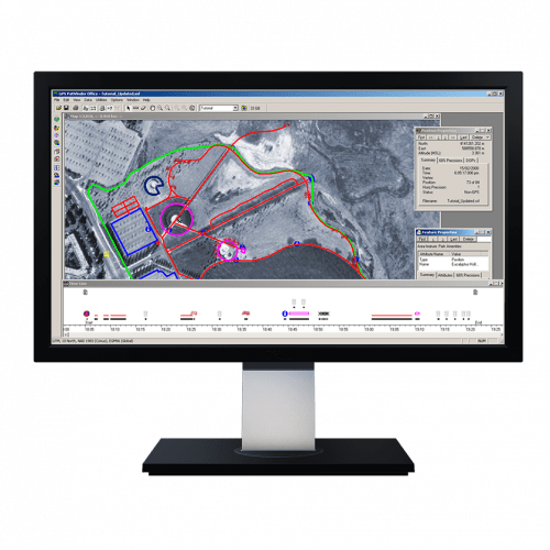 Powerful and easy to use GNSS/GPS data processing software.
 -
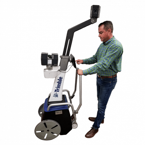 The Trimble Indoor Mobile Mapping Solution (TIMMS) is the optimal fusion of technologies for capturing spatial data of indoor and other GNSS denied areas.
 -
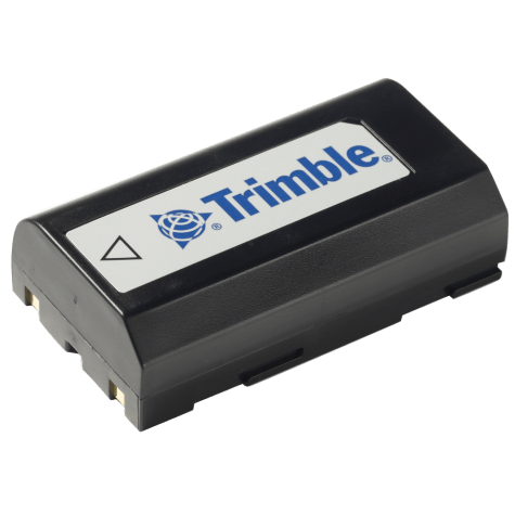 Accessory - MT1000, R6, R8, Dini Battery
 -
 Both active & passive tracking to locate and lock-on to the correct target
 -

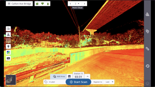
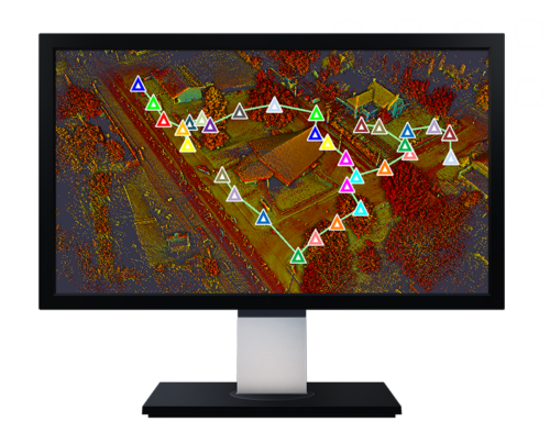
 The Trimble® MX50 is a practical field-to-finish mobile mapping solution for asset management, mapping, and road maintenance. The system delivers a very accurate point cloud of the environment along with complementary immersive imagery providing substantial gains in productivity. Contact your local Survey Sales Professional for a demonstration and full details.
 -
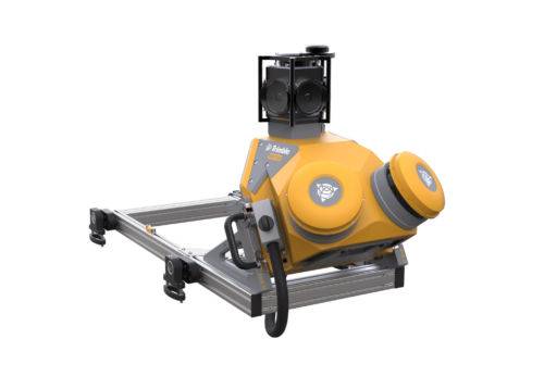
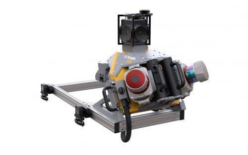 Trimble Mobile MX9 LiDAR Mapping Imaging Solution is for Large-Scale Scanning and Mapping Missions. The MX9 is a complete field-to-finish mobile mapping solution combining state-of-the-art, advanced hardware with intuitive field software and a reliable, efficient office software workflow. Contact your local Survey Sales Professional for a demonstration and full details.
 -
 Trimble Perspective field software is specifically designed for in-field scanner control and complete registration when working with a Trimble 3D laser scanning system like Trimble X9 or X12.
 -
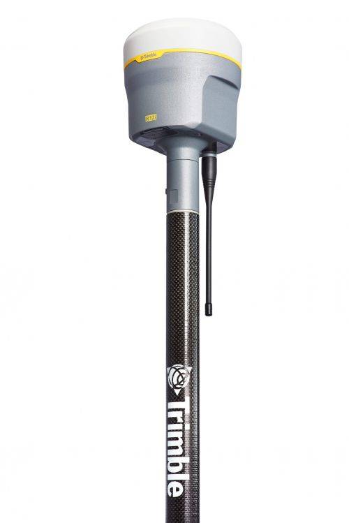
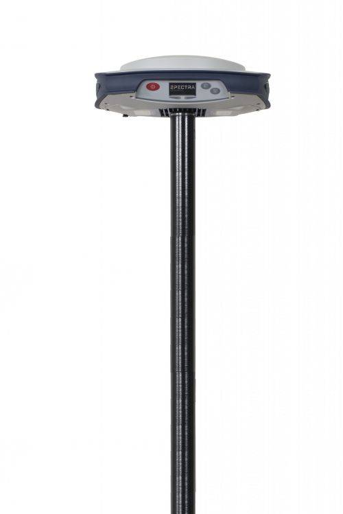
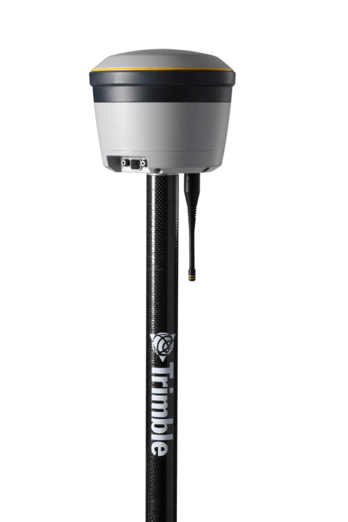
Trimble® R12i with Trimble ProPoint™ GNSS technology and new Trimble TIP™ tilt compensation
The R12i delivers unmatched GNSS performance, speed and accuracy to boost your productivity like never before. With improved performance in challenging GNSS conditions and robust IMU-based tilt compensation that lets you forget about leveling the pole, you'll get more done faster than you thought possible. Get the FAQs here! -
 The Trimble® R2 is a compact, durable GNSS receiver that provides an easy-to-use solution for GIS and survey professionals who need to collect highly accurate data in a wide range of geospatial applications.
 -
 Proven reliable positioning
Depend on the Trimble® R580 GNSS system to keep you working with survey precision. Powered by the industry-leading Trimble ProPoint® GNSS engine, this everyday integrated receiver delivers greater productivity and reliable accuracy in more places.
Benefits and performance
With increased accuracy and reliability in difficult urban and rural environments, the Trimble R580 optimizes productivity using powerful GNSS technologies for maximum results.Productivity maximized
The Trimble R580 harnesses Trimble ProPoint technology so you can survey with precision in difficult places, boosting field work productivity like never before.Trimble dependability
With proven technology to guard against anti-spoofing and multipath issues, the dependable R580 provides confidence for every measurement and point you capture. -
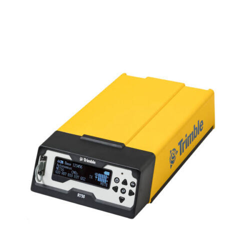
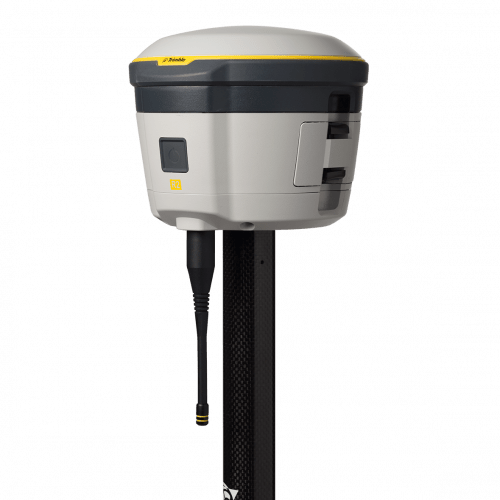
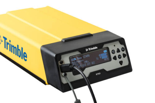 Get reliable coverage no matter where you work with the Trimble® R750 modular GNSS receiver. Work efficiently and accurately, even in tough conditions, while receiving all the information you need, right at your fingertips.
 -
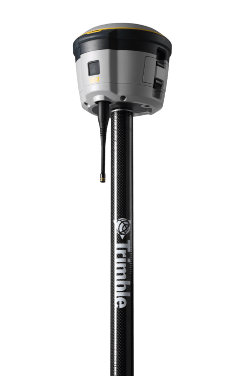
 The Trimble® R780 GNSS receiver allows you to choose your configuration and scale up by adding additional features. With robust GNSS positioning technologies, trust this ultra-durable receiver to boost your productivity and flexibility in any environment.
 -

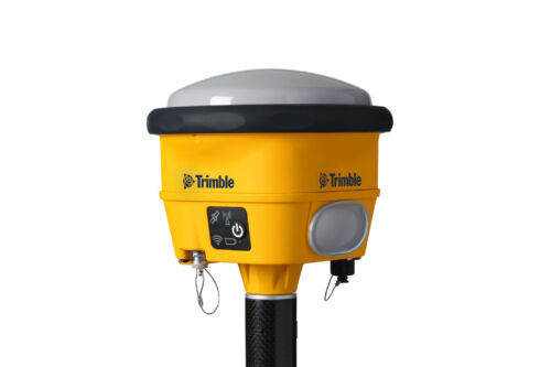
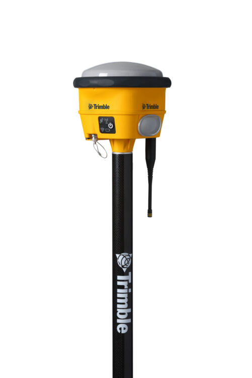
 Unmatched GNSS Performance With Connected Workflows to Elevate Survey Productivity. The Trimble® R980 GNSS system unlocks peak accuracy and connectivity with proven Trimble GNSS performance, now more powerful than ever before. Trimble ProPoint® GNSS technology ensures robust data capture even in tough environments, while high-performance Trimble Inertial Platform™ (Trimble TIP™) IMU-based tilt compensation keeps you focused on the job at hand.
 -
 Accessory - RTS/RPT - Li-Ion Battery compatible for all S and X series (except X12) batteries and plus Focus 30, RTK, SPS.
 -
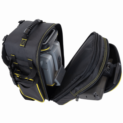
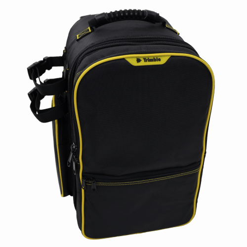 Features include: • Main compartment with custom foam insert for all Trimble S Series and VX instruments • Removable front compartment with built in backpack straps. Contains large front pocket for data collector and small front half pocket for small item storage • Side pockets for miscellaneous accessories•Padded back and adjustable shoulder straps for comfort • Durable 1680D Polyester fabric • Webbing system on both sides and bottom for securing additional equipment (2 straps included) • Airline carry-on compatible for most aircraft Approximate dimensions with instrument inside*: (*Note Instrument sold separately) Overall Dimensions: H: 440mm x W: 325mm x D: 305mm (17.25” x 12.75" x 12") Main instrument compartment depth when separated D: 216 mm (8.5”) Front controller compartment depth when separated D: 89mm (3.5”)
 -
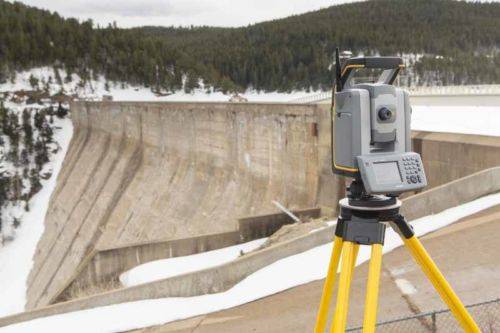
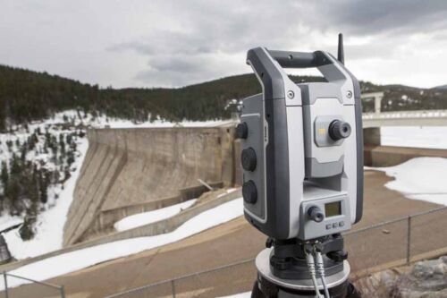
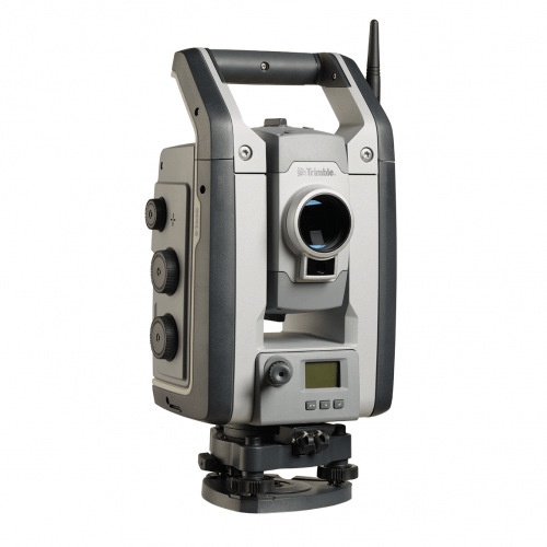
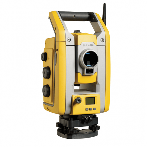 All you need to perform efficient surveying campaigns is available in the Trimble ® S5 Robotic Total Station solution. Built on proven Trimble technologies––including Trimble SurePoint and MagDrive™ technology, and our DR Plus EDM––this is the no nonsense workhorse that works efficiently and dependably while maintaining the highest possible accuracy.
 -
 Combining scanning, imaging and surveying into one powerful solution, the Trimble® S7 is a powerful total station with all of the features and tools you need to maximize efficiency in the field and in the office.
 -
 The Trimble® S9 is built for specialized applications, such as monitoring and tunneling where you need a solution with optimal speed, accuracy and reliability. Integrates the best field technologies, highest level of accuracy and specialized engineering features for the ultimate in performance and precision.
 -
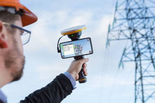
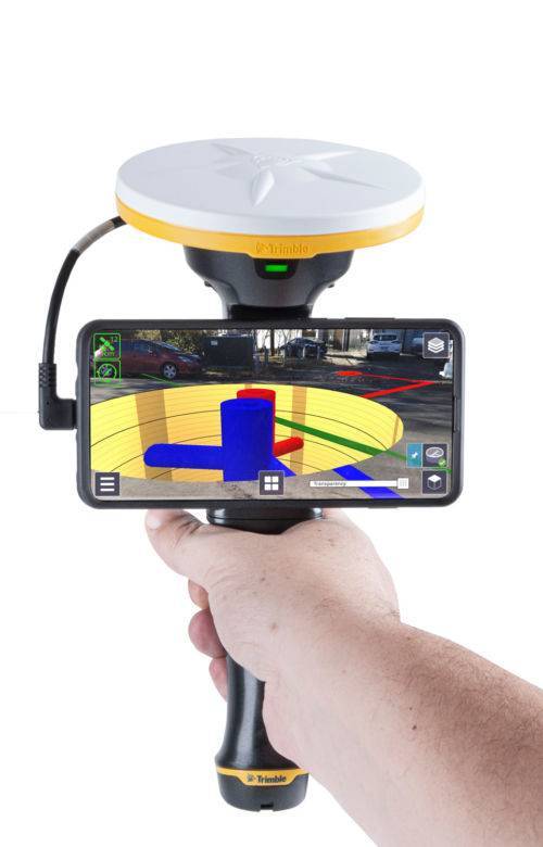 Trimble SiteVision is a user-friendly outdoor augmented reality system that brings data to life so you can visualize and explore complex information with unrivaled accuracy. Learn More Here.
 -
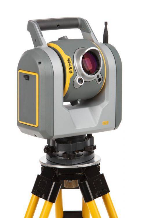
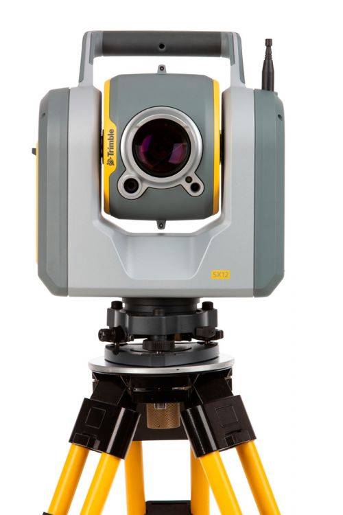
The Trimble SX12 Scanning Total Station merges high-speed 3D scanning, precision total station measurement, enhanced Trimble Vision and a green focusable laser pointer.
Note: Elevate Your Workflow to the Trimble SX12! Contact your Local Sales Professional Here to find out more about our exclusive trade-in details. Offer expires June 30th, 2024! Extended Capabilities; Do more when it matters the most. New green, eyesafe, focusable laser pointer yields the smallest spot size in the industry (just 3 mm at 50 m), so you can work from longer range and stay safe. The SX12 with Wi-Fi HaLow is the latest configuration See FAQ's here. The SX12 also comes in two configurations (with or without green laser) - Contact us for details. -
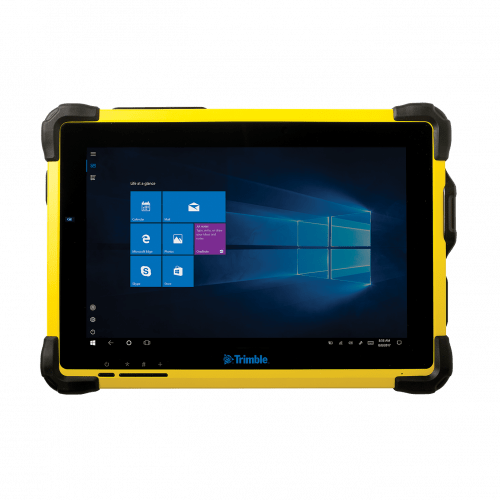 The Trimble® T10 tablet brings the advantages of fast computing power and a large screen to the field. Combined with integrated GNSS capabilities, the T10 is a powerful, rugged device created for survey fieldwork, mapping, and GIS data collection and at the same time supports demanding desktop applications.
