-
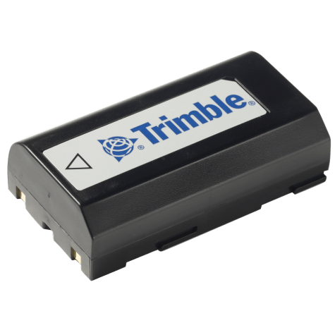 Accessory - MT1000, R6, R8, Dini Battery
 -
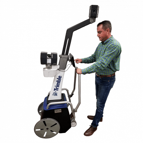 The Trimble Indoor Mobile Mapping Solution (TIMMS) is the optimal fusion of technologies for capturing spatial data of indoor and other GNSS denied areas.
 -
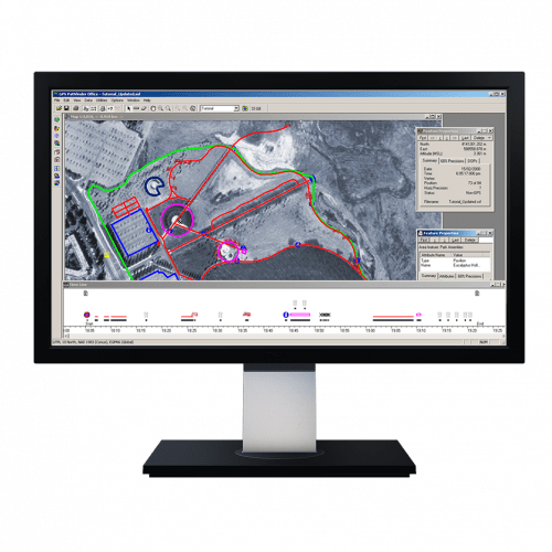 Powerful and easy to use GNSS/GPS data processing software.
 -
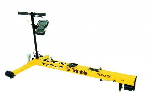
Trimble GEDO Track is a simple, integrated system to measure for precise adjustments, inspections and quality checks. In one operation, the Trimble GEDO captures the 3D coordinates of the track, together with gauge and cant. With its precision measurement systems, Trimble GEDO is suitable for conventional and high-speed rail construction. Contact us for more details and quote
KEY BENEFITS
- Reduce construction time and costs with immediate comparison of measured data to design
- Verify track geometry with accuracy and confidence. Precise optical positioning and a simple, self-contained trolley provide flexibility and reliable results
- Capture track 3D coordinates, gauge and cant in a single operation
- Import alignment design from digital or paper plans. Check design information before it goes to the job site
- Reduce time for documentation and acceptance. Capture adjustment and track acceptance data and quickly prepare reports for contractors and quality inspection
- Support for industry standard calculations including FAKOP® widening
- Satisfy reporting requirements with graphical and list form output of corrections for side and height correction plates
-
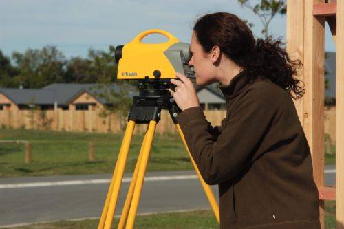
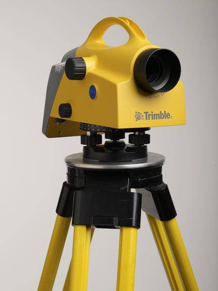 Trimble DiNi Level Digital Height measurement sensor - Trimble Quality and Accuracy for Measuring with Confidence. Contact us to buy or learn more.
- Determine accurate height information 60% faster than with automatic leveling
- Eliminate errors and reduce rework with digital readings
- Transfer data to the office easily
- Level Accuracy 0.3 or 0.7 mm
-

 The Trimble DA2 GNSS receiver is the next generation receiver for the Trimble® Catalyst™ GNSS positioning service. The DA2's performance scales with your Trimble Catalyst service subscription to deliver anywhere from centimeter to sub-meter precision to location-enabled Android™ and iOS field apps & workflows. Order or learn more here about Catalyst.
 -
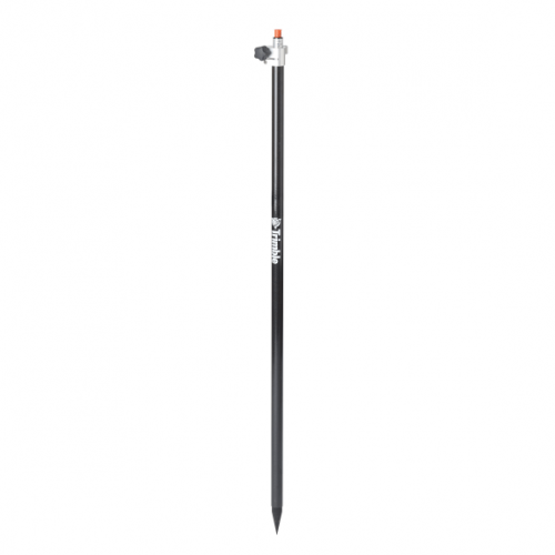 Rod - 2.5m Carbon Fiber Telescopic Range Pole without Bipod
 -
 Trimble Business Center is Office Software for Surveyors. Contact us for a demonstration and/or quote. Complete your field to finish workflows and expand business opportunities with unique deliverables:
- Topographic base map creation for construction and land development
- Cadastral/ALTA drawings for boundary mapping
- Workflow automation through using templates and feature coding
- Perform Cut/Fill Map analysis, Corridor Design, Inspections and Volume Computations
-
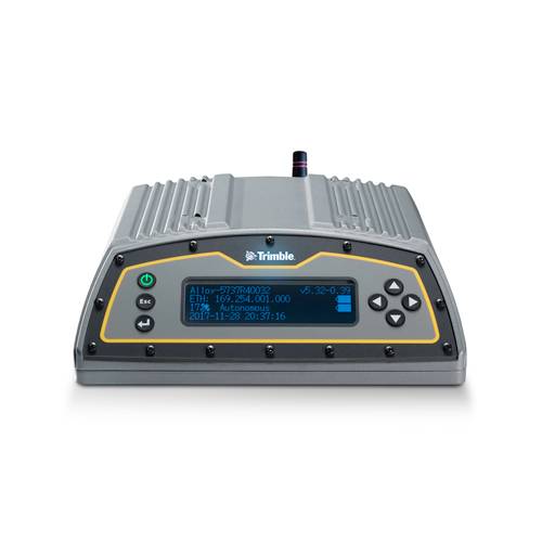 The Trimble Alloy™ reference receiver is ready to take on the requirements of any real-time network, in any environment, anywhere in the World. With tough IP68 housing, and modernized satellite tracking Trimble Alloy receiver can also be used as a campaign receiver for post-processing, as a Continuously Operating Reference Station (CORS) receiver or portable base station for Real-time Kinematic (RTK) applications – and even as a scientific reference station.
 -
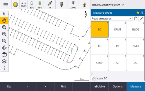
 Trimble Access™ software suite offers surveyors and geospatial professionals a range of specialized field applications designed to make fieldwork easier.
 -
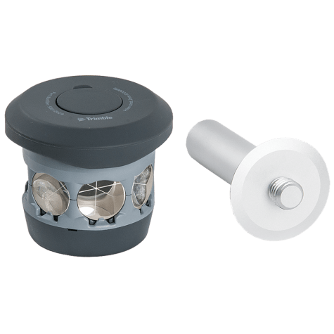 The 360 prism designed for Integrated Surveying with the Trimble R10 GNSS receiver. Compatible with all optical instruments. Request a quote - contact us. Accessory - RTS/RPT - 360 Prism includes height adapter to Trimble Standard target height (135mm).
 -
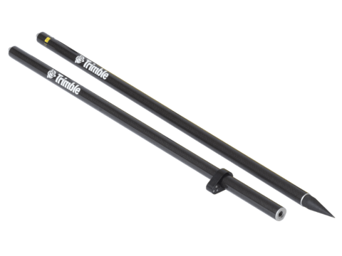 Accessory - Layout Rod - 2m Fixed Height Carbon Fiber Rod. Fixed height two part, 2 meter, carbon fiber range pole. P/N: 43169-10
