-
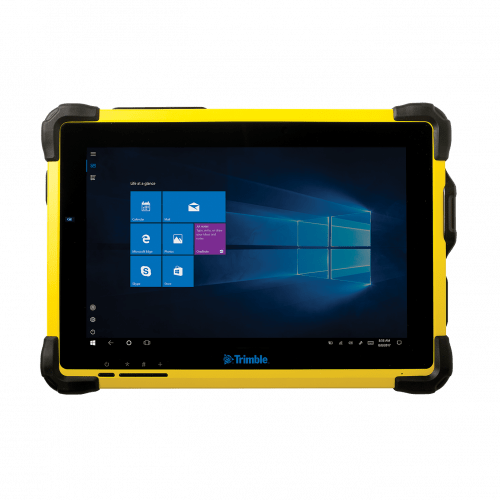 The Trimble® T10 tablet brings the advantages of fast computing power and a large screen to the field. Combined with integrated GNSS capabilities, the T10 is a powerful, rugged device created for survey fieldwork, mapping, and GIS data collection and at the same time supports demanding desktop applications.
 -
 Trimble Business Center is Office Software for Surveyors. Contact us for a demonstration and/or quote. Complete your field to finish workflows and expand business opportunities with unique deliverables:
- Topographic base map creation for construction and land development
- Cadastral/ALTA drawings for boundary mapping
- Workflow automation through using templates and feature coding
- Perform Cut/Fill Map analysis, Corridor Design, Inspections and Volume Computations
-
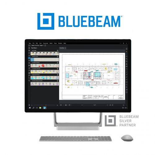 Bluebeam® Revu® is a PDF markup and editing software designed specifically for the AEC industry that allows for greater collaboration and efficiency—anytime, anywhere. Request a free 30-day trial or contact us for a quote.
 -
 Trimble® TerraFlex™ is a flexible and easy-to-use cloud-based solution for field data collection that enables you to capture standardized, consistent data on your Android device. Add Trimble Catalyst to your TerraFlex field workflows to access high accuracy positions when and where you need them, using only a lightweight antenna that plugs into your Android smartphone. Contact your local Seiler GIS professional for details or purchase your TerraFlex software solution here.
 -
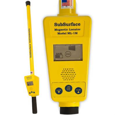 The ML-1 is one of SSI's longest-enduring and popular products for magnetic detection. Whether you're seeking corner markers (iron or steel), well casings, steel drums or septic tank handles, this is the go-to magnetic locator for you.
 -
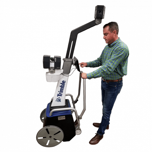 The Trimble Indoor Mobile Mapping Solution (TIMMS) is the optimal fusion of technologies for capturing spatial data of indoor and other GNSS denied areas.
 -
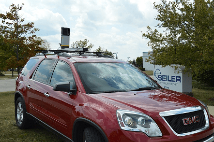
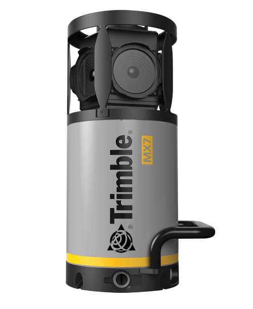 Contact us for details and special pricing! This demonstration unit has full warranty on hardware! The Trimble MX7 is a vehicle-mounted photogrammetric system equipped with six, 5 megapixel cameras, and Trimble Applanix GNSS and inertial geo-referencing modules. The Trimble MX7 can be deployed on vehicles of all sizes, letting you capture 30 MP geo-referenced images at highway speeds.
 -
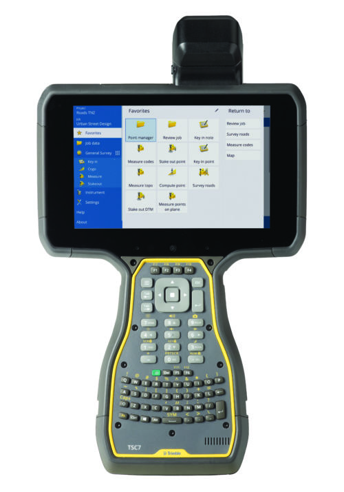
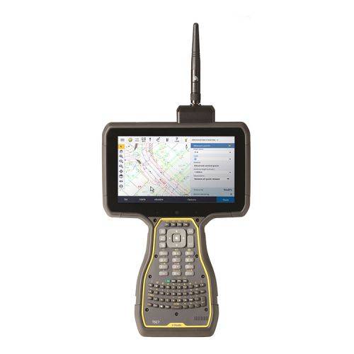 The Trimble® TSC7 controller with Trimble Access™ field software combines the power of a tablet, laptop and survey-rugged design into one device.
 -
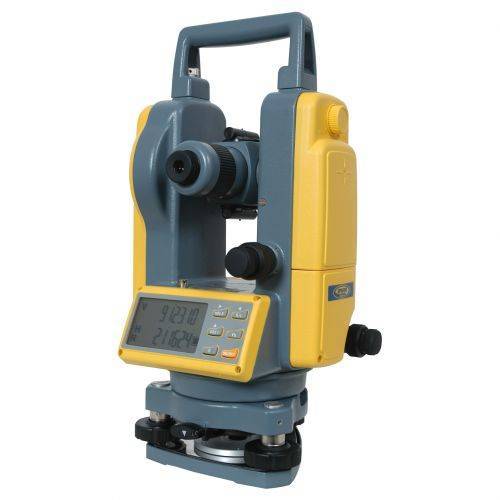 DET-2 Construction Theodolite The Spectra Precision® DET-2 is a rugged, cost-effective theodolite designed to give accurate angle measurements in general construction applications.
 -
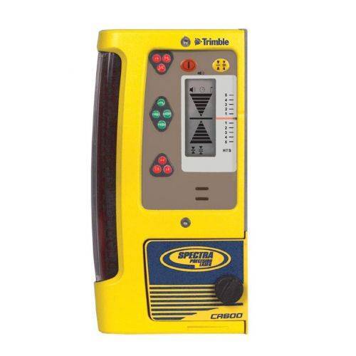 The CR600 can be either rod or machine mounted, making it ideal for a wide range of applications.
 -
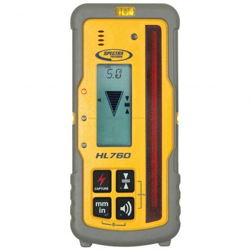 Works with LL400HV, HV302, GL412 and GL422N in automatic Grade Match and PlaneLok applications.
 -
 Highly versatile laser receiver for basic and advanced leveling and aligning applications
