-
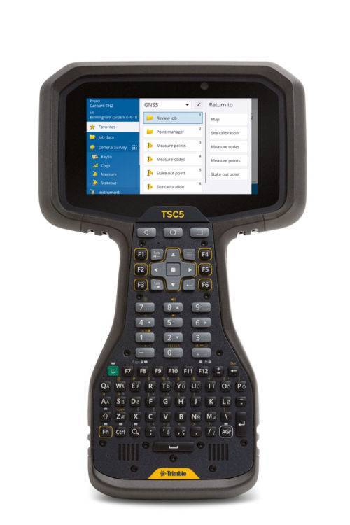
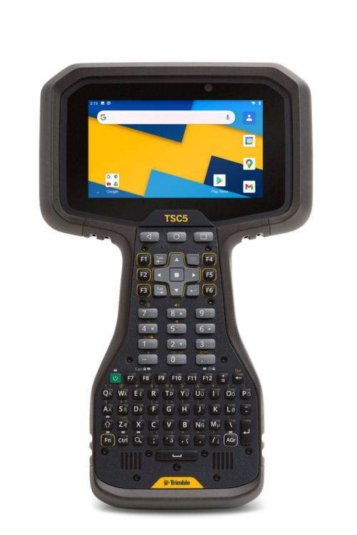 The Trimble® TSC5 controller is an Android-based survey controller featuring a five-inch screen and full keyboard—ensuring fast, efficient operation, even while wearing gloves. Rugged yet lightweight, with all-day battery power, the TSC5 is easy to carry and easy to use. Contact us for a demo today. The TSC5 is a new way to work - if you are familiar with the Trimble TSC3 controller, it’s been the mainstay of many surveyors’ field kit. The NEW Trimble TSC5 controller offers all the benefits of the TSC3, brought up to date with an Android operating system. Read more here!
 -
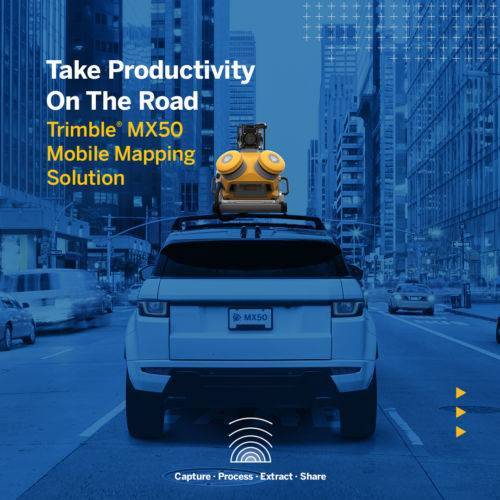
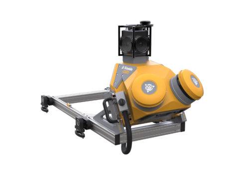 The Trimble® MX50 is a practical field-to-finish mobile mapping solution for asset management, mapping, and road maintenance. The system delivers a very accurate point cloud of the environment along with complementary immersive imagery providing substantial gains in productivity. Contact your local Survey Sales Professional for a demonstration and full details.
 -
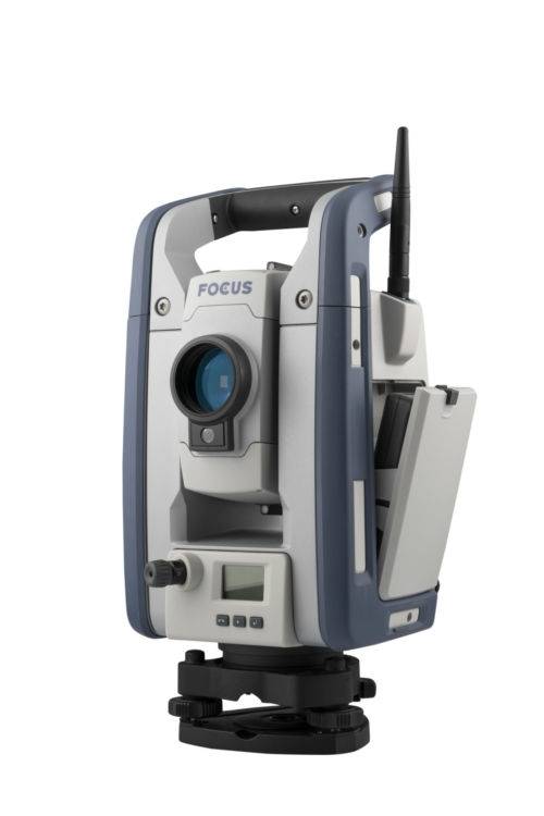
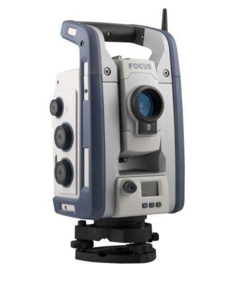 The Spectra Geospatial FOCUS 50 is the new robotic total station you can customize to fit your needs. Available in three models, with your choice of accuracy, the FOCUS 50 features the smoothness of MagDrive the stability of Autolock, and it is compatible with the latest Spectra Geospatial Origin software. Email us at [email protected] or Contact us to learn more https://www.seilergeo.com/wp-content/uploads/sites/9/2021/11/Spectra-Focus50-EN-1-1.mp4
 -
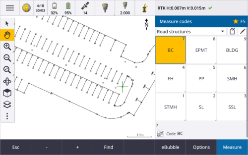
 Trimble Access™ software suite offers surveyors and geospatial professionals a range of specialized field applications designed to make fieldwork easier.
 -
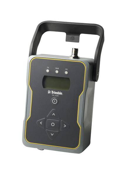
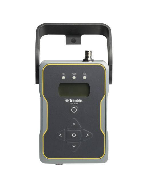 Designed to support all aspects of GNSS surveying, the Trimble TDL 450 UHF data radio offers flexible configuration options and rugged reliability.
 -
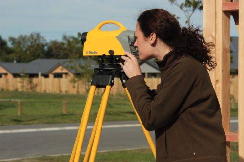
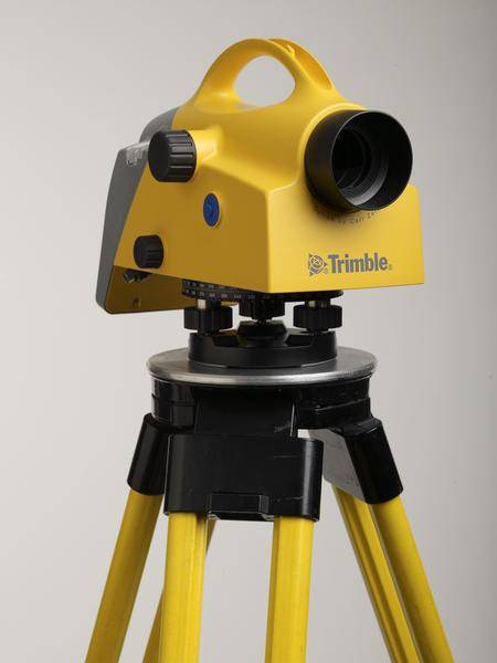 Trimble DiNi Level Digital Height measurement sensor - Trimble Quality and Accuracy for Measuring with Confidence. Contact us to buy or learn more.
- Determine accurate height information 60% faster than with automatic leveling
- Eliminate errors and reduce rework with digital readings
- Transfer data to the office easily
- Level Accuracy 0.3 or 0.7 mm
-
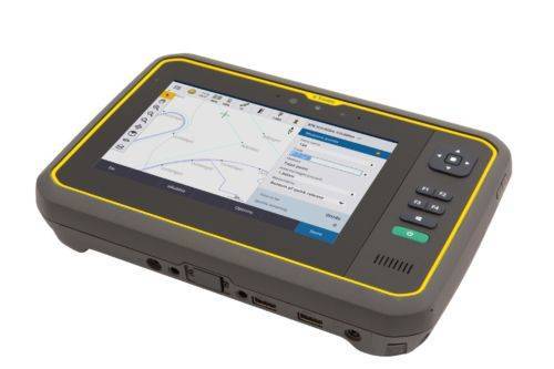
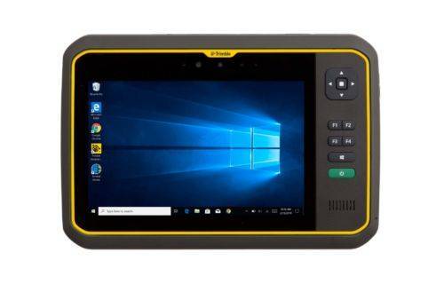 The Trimble® T7 tablet is purpose-built for demanding survey and GIS applications. Featuring a powerful processor, Windows® 10 OS, large memory and a modern user interface, the T7 is a fast, reliable field computer for surveyors and GIS workers alike. Capturing data, visualizing and manipulating maps, and running office applications out on the job site is easy with the T7—and it’s all packaged in a rugged, compact, highly portable device. Contact us to learn more.
 -
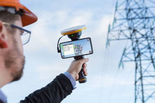
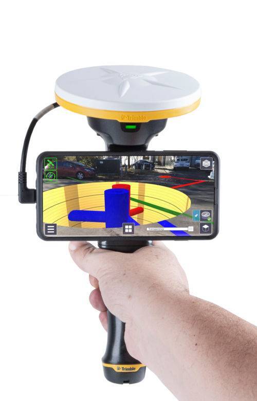 Trimble SiteVision is a user-friendly outdoor augmented reality system that brings data to life so you can visualize and explore complex information with unrivaled accuracy. Learn More Here.
 -
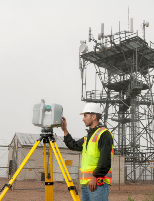
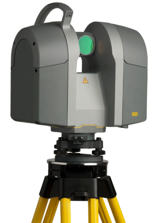 The Trimble® TX8 laser scanner sets new standards for performance and ease of use in high-speed collection of 3D data. Using a state-of-the-art blend of speed, long range and precision, the Trimble TX8 delivers high quality results in civil survey, industrial measurement, engineering and construction. It’s the scanner of choice for high levels of productivity, accuracy and flexibility. Contact your local Survey Sales Specialist to find out more.The Trimble TX8 is designed for a broad array of uses and environments. Typical applications include: ► Civil engineering ► Surveying ► Plant and industrial measurement ► Mining and quarries ► Urban areas ► Preservation and restoration ► Building and commercial construction ► Deformation monitoring ► Quality control ► Public safety and forensicsDetailed Data Sheet
 -
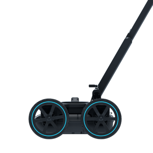
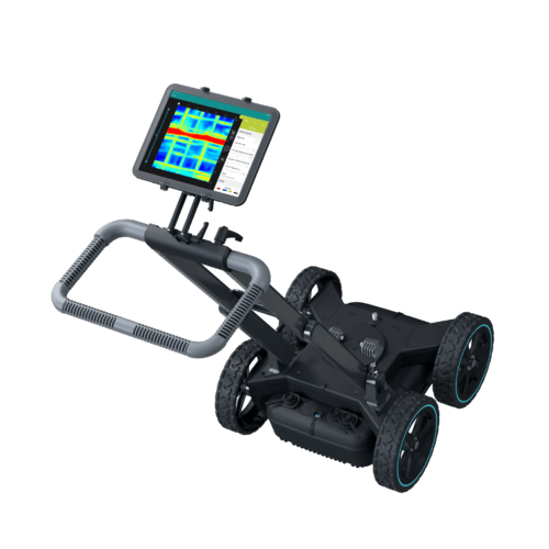 Screening Eagle Proceq GS8000 Subsurface Mapping System.
The revolutionary Proceq GS8000 is the world’s most advanced subsurface mapping system, equipped with Stepped-Frequency Continuous-Wave (SFCW) technology and precise GNSS positioning. The true-ultrawideband antenna system and Swiss-made, optimized electronics deliver unparalleled resolution and penetration depth - at the same time. Contact us to learn more via email here.
-
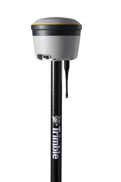
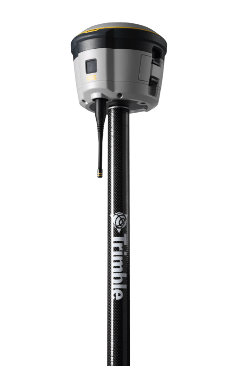 Proven reliable positioning
Depend on the Trimble® R580 GNSS system to keep you working with survey precision. Powered by the industry-leading Trimble ProPoint® GNSS engine, this everyday integrated receiver delivers greater productivity and reliable accuracy in more places.
Benefits and performance
With increased accuracy and reliability in difficult urban and rural environments, the Trimble R580 optimizes productivity using powerful GNSS technologies for maximum results.Productivity maximized
The Trimble R580 harnesses Trimble ProPoint technology so you can survey with precision in difficult places, boosting field work productivity like never before.Trimble dependability
With proven technology to guard against anti-spoofing and multipath issues, the dependable R580 provides confidence for every measurement and point you capture. -
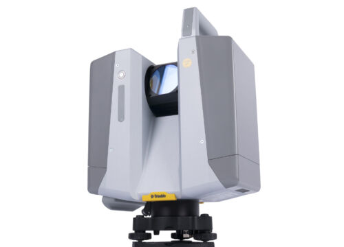
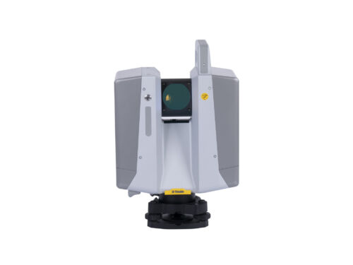 The Trimble X12 is a 3D laser scanner with the speed, accuracy, range and HDR imaging to capture the highest quality data available to produce impressive deliverables for demanding projects.
