-
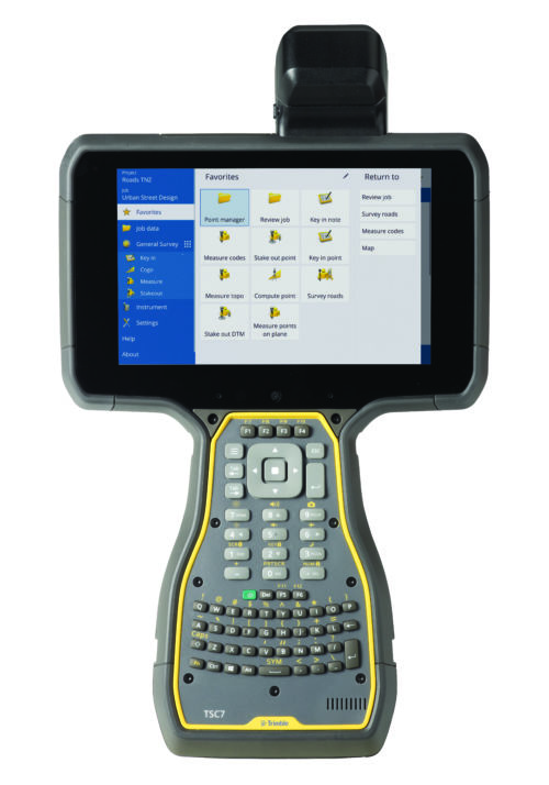
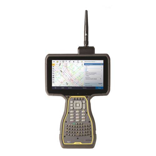 The Trimble® TSC7 controller with Trimble Access™ field software combines the power of a tablet, laptop and survey-rugged design into one device.
 -
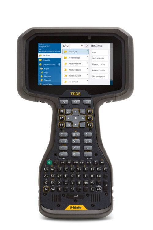
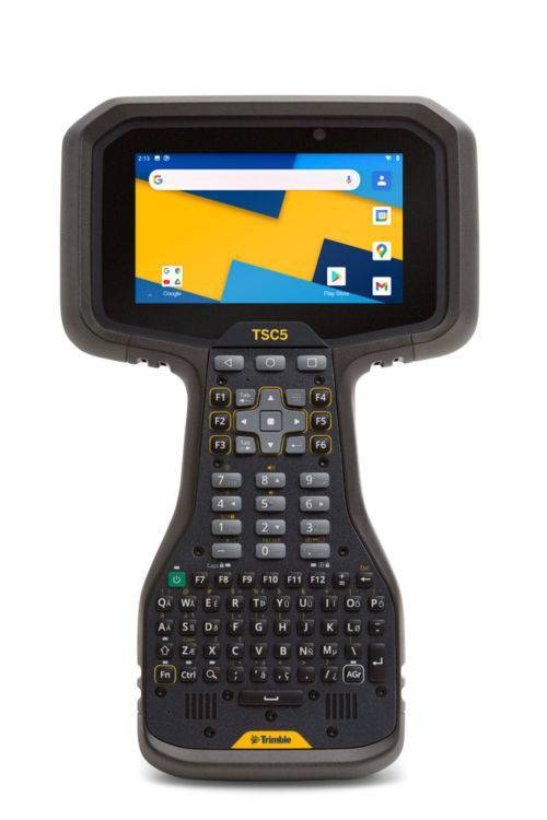 The Trimble® TSC5 controller is an Android-based survey controller featuring a five-inch screen and full keyboard—ensuring fast, efficient operation, even while wearing gloves. Rugged yet lightweight, with all-day battery power, the TSC5 is easy to carry and easy to use. Contact us for a demo today. The TSC5 is a new way to work - if you are familiar with the Trimble TSC3 controller, it’s been the mainstay of many surveyors’ field kit. The NEW Trimble TSC5 controller offers all the benefits of the TSC3, brought up to date with an Android operating system. Read more here!
 -
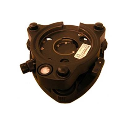 Accessory - RTS - Tribrach with Optical Plummet
 -
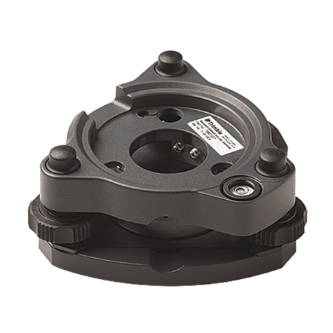 Replacement Tribrach for Trimble S Series instruments or Trimble Traverse Prism kit. Also compatible with Trimble SX10 instrument.
 -
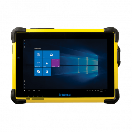 The Trimble® T10 tablet brings the advantages of fast computing power and a large screen to the field. Combined with integrated GNSS capabilities, the T10 is a powerful, rugged device created for survey fieldwork, mapping, and GIS data collection and at the same time supports demanding desktop applications.
 -
 Both active & passive tracking to locate and lock-on to the correct target
 -
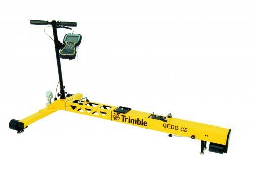
Trimble GEDO Track is a simple, integrated system to measure for precise adjustments, inspections and quality checks. In one operation, the Trimble GEDO captures the 3D coordinates of the track, together with gauge and cant. With its precision measurement systems, Trimble GEDO is suitable for conventional and high-speed rail construction. Contact us for more details and quote
KEY BENEFITS
- Reduce construction time and costs with immediate comparison of measured data to design
- Verify track geometry with accuracy and confidence. Precise optical positioning and a simple, self-contained trolley provide flexibility and reliable results
- Capture track 3D coordinates, gauge and cant in a single operation
- Import alignment design from digital or paper plans. Check design information before it goes to the job site
- Reduce time for documentation and acceptance. Capture adjustment and track acceptance data and quickly prepare reports for contractors and quality inspection
- Support for industry standard calculations including FAKOP® widening
- Satisfy reporting requirements with graphical and list form output of corrections for side and height correction plates
-
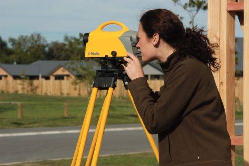
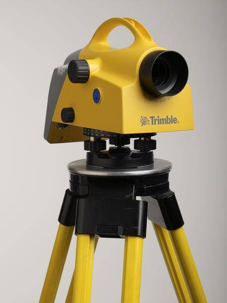 Trimble DiNi Level Digital Height measurement sensor - Trimble Quality and Accuracy for Measuring with Confidence. Contact us to buy or learn more.
- Determine accurate height information 60% faster than with automatic leveling
- Eliminate errors and reduce rework with digital readings
- Transfer data to the office easily
- Level Accuracy 0.3 or 0.7 mm
-
 Trimble Business Center is Office Software for Surveyors. Contact us for a demonstration and/or quote. Complete your field to finish workflows and expand business opportunities with unique deliverables:
- Topographic base map creation for construction and land development
- Cadastral/ALTA drawings for boundary mapping
- Workflow automation through using templates and feature coding
- Perform Cut/Fill Map analysis, Corridor Design, Inspections and Volume Computations
-
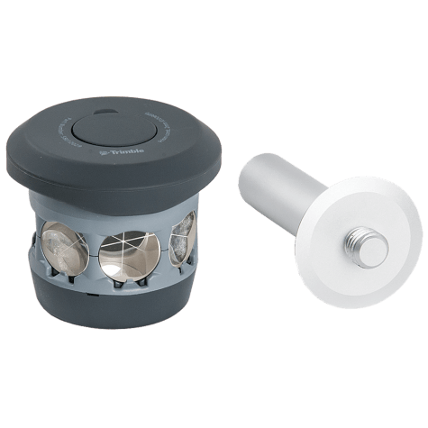 The 360 prism designed for Integrated Surveying with the Trimble R10 GNSS receiver. Compatible with all optical instruments. Request a quote - contact us. Accessory - RTS/RPT - 360 Prism includes height adapter to Trimble Standard target height (135mm).
 -
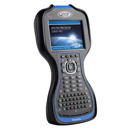 The third generation Spectra Geospatial Ranger™ Data Collector offers a large bright touch-screen, full alpha-numeric, easy to operate, keypad, and is packed with the features surveyors depend on.
 -
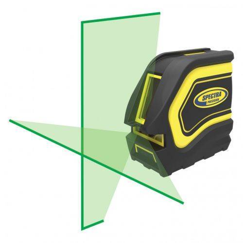 For interior building and remodeling, the LT20G laser tool is ideal for brighter working conditions
